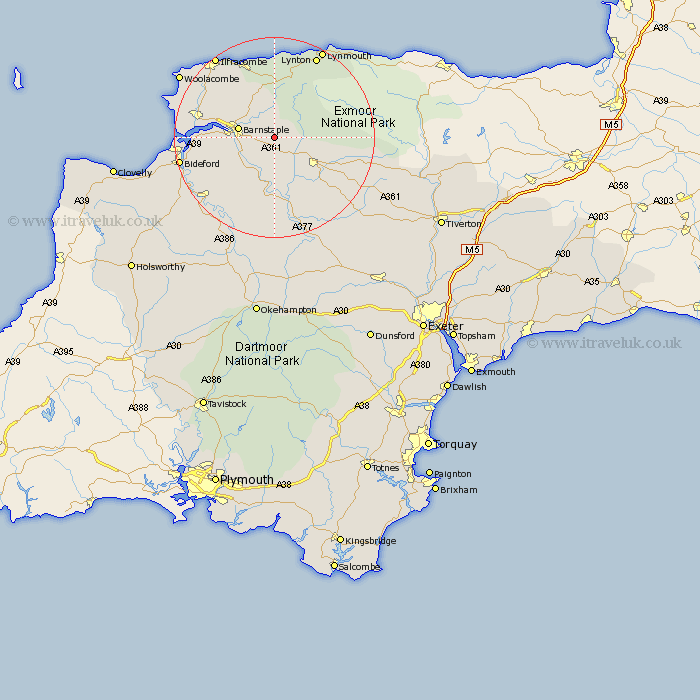
Devon Map Showing Location of Gunn
District: North Devon
Easting: 263384 Northing: 131571
Latitude: 51.07 Longitude: -3.95
 = Gunn
Easting: 263384 Northing: 131571
Latitude: 51.07 Longitude: -3.95
= Gunn
This Gunn map below is supplied by Google. Use the tools in the top left corner to zoom into street level or zoom out for a road map, you may also need to zoom in to see Gunn on the map. Click and drag the map to move around. If the map fails to load try and refresh your browser or zoom in or out (+ or -).
Update - it seems Google no longer allow people to use their maps for free! This Gunn map sometimes loads and sometimes gives a error. I am working on a solution.
Closest 30 Towns or Cities to Gunn (Population over 500)
Swimbridge 2.19km Chittlehampton 5.56km Bratton Fleming 5.56km Barnstaple 7.23km Tawstock 7.23km South Molton 9.87km North Molton 10.64km Marwood 10.85km Fremington 11.65km High Bickington 11.65km Burrington 14.83km Barrington 14.83km Instow 15.26km Combe Martin 15.93km West Down 16.1km Braunton 16.72km Berrynarbor 16.91km Appledore 17.57km Chulmleigh 17.67km Linton 18.56km Lynton 18.56km Georgeham 18.96km Northam 19.01km Torrington 19.08km Great Torrington 19.08km Bideford 19.46km Chawleigh 20.25km Ilfracombe 20.33km Iltracombe 20.33km Dolton 21.21km