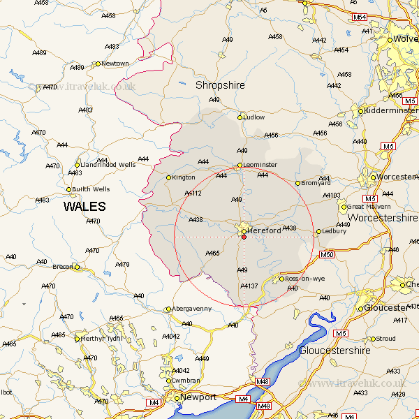
Herefordshire Map Showing Location of Bullingham
Population: 1565
Easting: 350841 Northing: 237499
Latitude: 52.03 Longitude: -2.72
 = Bullingham
Easting: 350841 Northing: 237499
Latitude: 52.03 Longitude: -2.72
= Bullingham
This Bullingham map below is supplied by Google. Use the tools in the top left corner to zoom into street level or zoom out for a road map, you may also need to zoom in to see Bullingham on the map. Click and drag the map to move around. If the map fails to load try and refresh your browser or zoom in or out (+ or -).
Update - it seems Google no longer allow people to use their maps for free! This Bullingham map sometimes loads and sometimes gives a error. I am working on a solution.
Closest 30 Towns or Cities to Bullingham (Population over 500)
Hereford 1.86km Allensmore 4.92km Lugwardine 5.88km Mordiford 6km Much Dewchurch 6.01km Much Birch 7.41km Moreton 7.5km Moreton on Lugg 7.5km Moreton-on-Lugg 7.5km Sutton 7.76km Burghill 8.17km Kingstone 8.19km Fownhope 8.8km Madley 9.12km Credenhill 9.35km Withington 9.35km Wellington 11.35km Bodenham 13.18km Ewyas Harold 14.7km Much Marcle 15.28km Peterchurch 15.96km Upton Bishop 16.53km Ross on Wye 16.54km Ross-on-wye 16.54km Ross 16.54km Broad Oak 16.83km Weobley 18.03km Weston 18.05km Weston under Penyard 18.05km Weston-under-Penyard 18.05km