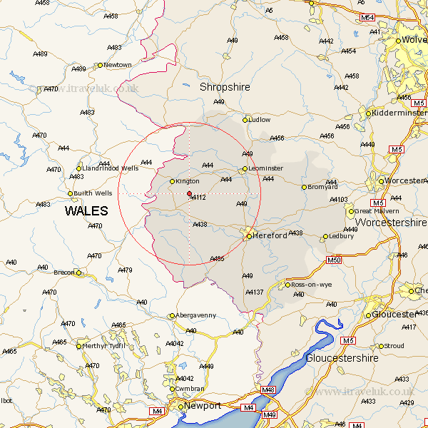
Herefordshire Map Showing Location of Woonton
Easting: 335031 Northing: 252518
Latitude: 52.17 Longitude: -2.95
 = Woonton
Latitude: 52.17 Longitude: -2.95
= Woonton
This Woonton map below is supplied by Google. Use the tools in the top left corner to zoom into street level or zoom out for a road map, you may also need to zoom in to see Woonton on the map. Click and drag the map to move around. If the map fails to load try and refresh your browser or zoom in or out (+ or -).
Update - it seems Google no longer allow people to use their maps for free! This Woonton map sometimes loads and sometimes gives a error. I am working on a solution.
Closest 30 Towns or Cities to Woonton (Population over 500)
Almeley 2.94km Lyonshall 4.34km Eardisley 5.04km Weobley 5.68km Kington 5.86km Dilwyn 5.97km Pembridge 6.52km Eardisland 8.8km Shobdon 10.86km Clifford 12.64km Credenhill 12.64km Kingsland 13.79km Wellington 14.14km Burghill 14.55km Peterchurch 14.83km Madley 16.33km Croft 16.51km Leominster 16.52km Moreton-on-Lugg 16.54km Moreton on Lugg 16.54km Moreton 16.54km Luston 17.59km Wigmore 18.02km Bodenham 18.29km Kingstone 18.49km Sutton 19.65km Orleton 20.13km Allensmore 20.2km Hereford 20.55km Bullingham 21.77km