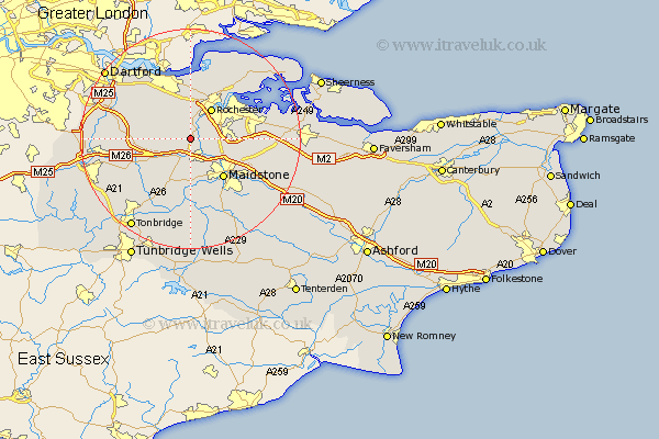
Kent Map Showing Location of Halling
Easting: 569492 Northing: 162223
Latitude: 51.33 Longitude: 0.43
 = Halling
Latitude: 51.33 Longitude: 0.43
= Halling
This Halling map below is supplied by Google. Use the tools in the top left corner to zoom into street level or zoom out for a road map, you may also need to zoom in to see Halling on the map. Click and drag the map to move around. If the map fails to load try and refresh your browser or zoom in or out (+ or -).
Update - it seems Google no longer allow people to use their maps for free! This Halling map sometimes loads and sometimes gives a error. I am working on a solution.
Closest 30 Towns or Cities to Halling (Population over 500)
Snodland 1.85km Cuxton 2.19km Wouldham 2.32km Burham 3.93km Ryarsh 5.08km Meopham 5.94km West Malling 6.02km Cobham 6.02km Addington 6.02km Aylesford 6.56km Rochester 6.68km Strood 7.23km Offham 7.24km East Malling 7.41km Shorne 7.42km Chatham 8.02km Ridley 8.1km Hartley 8.91km Wrotham 8.91km Wateringbury 9.34km Maidstone 9.4km Ash 9.45km Barming 9.55km East Barming 9.55km Longfield 9.82km Boxley 9.83km Mereworth 10.36km Gillingham 10.69km Borough Green 10.81km Southfleet 10.98km