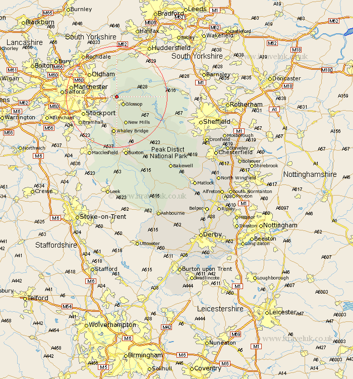
Derbyshire Map Showing Location of Tintwhistle
Population: 1401
District: High Peak
Easting: 402212 Northing: 396690
Latitude: 53.47 Longitude: -1.97
 = Tintwhistle
District: High Peak
Easting: 402212 Northing: 396690
Latitude: 53.47 Longitude: -1.97
= Tintwhistle
This Tintwhistle map below is supplied by Google. Use the tools in the top left corner to zoom into street level or zoom out for a road map, you may also need to zoom in to see Tintwhistle on the map. Click and drag the map to move around. If the map fails to load try and refresh your browser or zoom in or out (+ or -).
Update - it seems Google no longer allow people to use their maps for free! This Tintwhistle map sometimes loads and sometimes gives a error. I am working on a solution.
Closest 30 Towns or Cities to Tintwhistle (Population over 500)
Glossop 4.13km Charlesworth 4.32km Hayfield 9.34km New Mills 11.6km Whaley Bridge 14.87km Chapel en le Frith 17.25km Hope 19.36km Castleton 19.89km Bradwell 22.01km Bamford 22.83km Buxton 24.32km Tideswell 25.9km Hathersage 26.82km Eyam 28.49km Grindleford 30.08km Grindleford Bridge 30.08km Stoney Middleton 30.59km Stony Middleton 30.59km Longstone 31.41km Great Longstone 31.41km Baslow 34.83km Bakewell 35.73km Holmesfield 36.15km Middleton 37.26km Youlgreave 37.77km Dronfield 37.99km Barlow 39.03km Brampton 40.41km Old Brampton 40.41km Unstone 40.84km