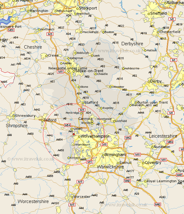
Staffordshire Map Showing Location of Tettenhall
District: Wolverhampton
Easting: 387584 Northing: 300300
Latitude: 52.6 Longitude: -2.18
 = Tettenhall
Easting: 387584 Northing: 300300
Latitude: 52.6 Longitude: -2.18
= Tettenhall
This Tettenhall map below is supplied by Google. Use the tools in the top left corner to zoom into street level or zoom out for a road map, you may also need to zoom in to see Tettenhall on the map. Click and drag the map to move around. If the map fails to load try and refresh your browser or zoom in or out (+ or -).
Update - it seems Google no longer allow people to use their maps for free! This Tettenhall map sometimes loads and sometimes gives a error. I am working on a solution.
Closest 30 Towns or Cities to Tettenhall (Population over 500)
Wolverhampton 3.85km Lower Penn 3.87km Codsall 3.87km Scisdon 5.83km Seisdon 5.83km Pattingham 5.93km Wombourn 7.42km Wombourne 7.42km Bilston 8.71km Brewood 9.33km Himley 9.53km Shareshill 10.03km Bobbington 11.47km Wallsall 12.38km Walsall 12.38km Weston-under-Lizard 13.01km Weston under Lizard 13.01km Weston 13.01km Dudley 13.01km Wheaton Aston 13.17km Great Wyrley 13.64km Wyrley 13.64km Cannock 14.57km Blymhill 14.62km Huntington 15.04km West Bromwich 15.47km Penkridge 15.49km Rushall 15.76km Pelsall 15.86km Hednesford 16.63km