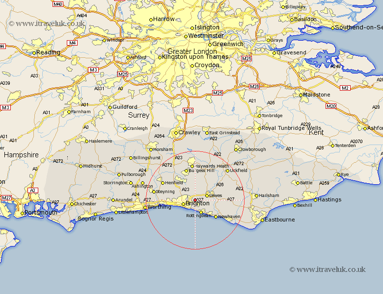
Sussex Map Showing Location of Stanmer
Easting: 534906 Northing: 107421
Latitude: 50.85 Longitude: -0.08
 = Stanmer
Latitude: 50.85 Longitude: -0.08
= Stanmer
This Stanmer map below is supplied by Google. Use the tools in the top left corner to zoom into street level or zoom out for a road map, you may also need to zoom in to see Stanmer on the map. Click and drag the map to move around. If the map fails to load try and refresh your browser or zoom in or out (+ or -).
Update - it seems Google no longer allow people to use their maps for free! This Stanmer map sometimes loads and sometimes gives a error. I am working on a solution.
Closest 30 Towns or Cities to Stanmer (Population over 500)
Plumpton 4.38km Kingston near Lewes 4.68km Kingston 4.68km Lewes 5.03km Brighton 5.04km Saltdean 5.81km Rottingdean 6.03km Hove 7.26km Ditchling 7.51km Ditchelling 7.51km Keymer 8.2km Hassocks 8.2km Hurstpierpoint 9.44km Portslade 9.54km Southwick 9.54km Barcombe Mills Station 9.9km Shoreham 10.69km Shoreham by Sea 10.69km New Shoreham 10.69km Shoreham-by-Sea 10.69km Newhaven 11.05km Wivelsfield 11.12km Ringmer 11.16km Albourne 11.62km Chailey 13.15km Burgess Hill 13.44km Isfield 14.02km Newick 14.75km Henfield 14.84km Baywards Heath 14.87km