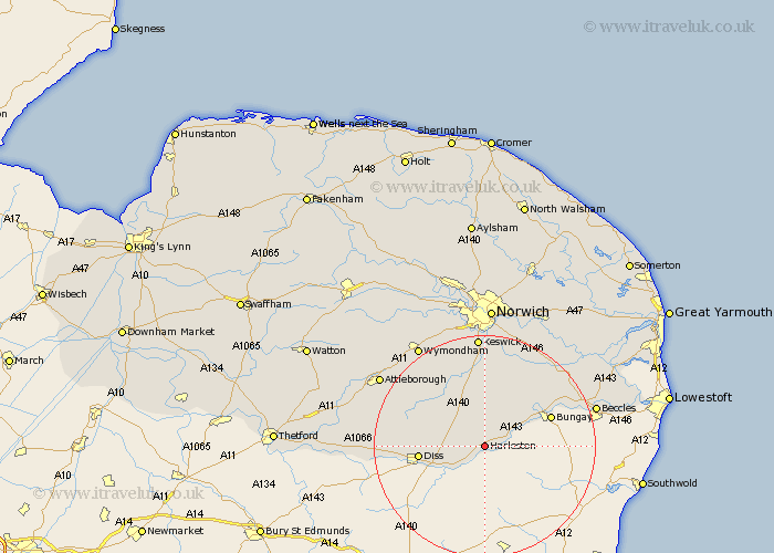
Norfolk Map Showing Location of Harleston
Population: 3684
Area Size (ha): 125
District: South Norfolk
Easting: 623335 Northing: 283112
Latitude: 52.4 Longitude: 1.28
 = Harleston
Area Size (ha): 125
District: South Norfolk
Easting: 623335 Northing: 283112
Latitude: 52.4 Longitude: 1.28
= Harleston
This Harleston map below is supplied by Google. Use the tools in the top left corner to zoom into street level or zoom out for a road map, you may also need to zoom in to see Harleston on the map. Click and drag the map to move around. If the map fails to load try and refresh your browser or zoom in or out (+ or -).
Update - it seems Google no longer allow people to use their maps for free! This Harleston map sometimes loads and sometimes gives a error. I am working on a solution.
Closest 30 Towns or Cities to Harleston (Population over 500)
Pulham 2.93km Brockdish 3.87km Scole 8.74km Burston 9.05km Long Stratton 9.86km Moulton 10.05km Moulton St. Michael 10.05km Great Moulton 10.05km Moulton Saint Michael 10.05km Moulton St Michael 10.05km Earsham 10.61km Hempnall 11.18km Diss 11.46km Forncett St Mary 12.47km Forncett 12.47km Forncett Saint Mary 12.47km Forncett St. Mary 12.47km Ditchingham 12.59km Roydon 12.98km Bunwell 13.75km Saxlingham 14.87km Saxlingham Thorpe 14.87km Ellingham 15.45km Ashwellthorpe 16.3km Stoke Holy Cross 16.72km Mulbarton 17.02km Bressingham 17.07km Poringland 17.28km Banham 17.84km Loddon 17.96km