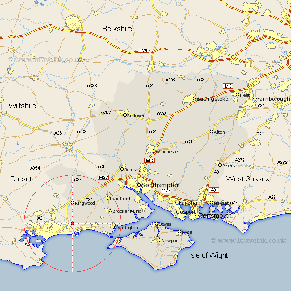
Hampshire Map Showing Location of Sopley
Population: 774
District: New Forest
Easting: 415278 Northing: 96431
Latitude: 50.77 Longitude: -1.78
 = Sopley
District: New Forest
Easting: 415278 Northing: 96431
Latitude: 50.77 Longitude: -1.78
= Sopley
This Sopley map below is supplied by Google. Use the tools in the top left corner to zoom into street level or zoom out for a road map, you may also need to zoom in to see Sopley on the map. Click and drag the map to move around. If the map fails to load try and refresh your browser or zoom in or out (+ or -).
Update - it seems Google no longer allow people to use their maps for free! This Sopley map sometimes loads and sometimes gives a error. I am working on a solution.
Closest 30 Towns or Cities to Sopley (Population over 500)
Bransgore 3.97km Burley 8.08km Ringwood 9.26km Barton 9.91km Barton-on-Sea 9.91km Barton on Sea 9.91km Milton 10.09km New Milton 10.09km Ibsley 12.97km Sway 13.02km Hordle 13.03km Sandleheath 13.17km Milford on Sea 14.19km Milford-on-Sea 14.19km Milford 14.19km Brockenhurst 16.21km Lymington 16.52km Boldre 17.58km Lyndhurst 17.92km Minstead 18.27km Fordingbridge 18.56km Damerham 19.11km South Damerham 19.11km Hale 20.68km Totland 20.82km Yarmouth 21.28km Cadnam 21.8km Freshwater 21.82km Bramshaw 21.91km Bewley 24.08km