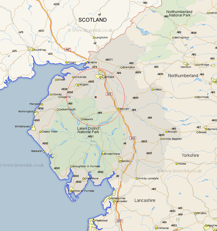
Cumbria Map Showing Location of Sebergham
Population: 361
District: Allerdale
Easting: 336714 Northing: 539904
Latitude: 54.75 Longitude: -2.98
 = Sebergham
District: Allerdale
Easting: 336714 Northing: 539904
Latitude: 54.75 Longitude: -2.98
= Sebergham
This Sebergham map below is supplied by Google. Use the tools in the top left corner to zoom into street level or zoom out for a road map, you may also need to zoom in to see Sebergham on the map. Click and drag the map to move around. If the map fails to load try and refresh your browser or zoom in or out (+ or -).
Update - it seems Google no longer allow people to use their maps for free! This Sebergham map sometimes loads and sometimes gives a error. I am working on a solution.
Closest 30 Towns or Cities to Sebergham (Population over 500)
Hesket Newmarket 2.83km Caldbeck 4.66km Dalston 9.26km Skelton 9.33km Thursby 10.2km Westward 10.31km Greystoke 13.41km Wigton 14.14km Carlisle 15.16km Wetheral 16.81km Ainstable 16.97km Stanwix 16.98km Dacre 17.68km Kirkoswald 18.27km Lasonby 18.28km Lazonby 18.28km Keswick 18.75km Koswick 18.75km Bromfield 19km Burgh 19.02km Burgh-by-Sands 19.02km Burgh by Sands 19.02km Kirkbride 20.31km Rockcliff 20.38km Rockcliffe 20.38km Langwathby 21.65km Hayton 22.4km Aspatria 22.46km Irthington 24.66km Cockermouth 25.31km