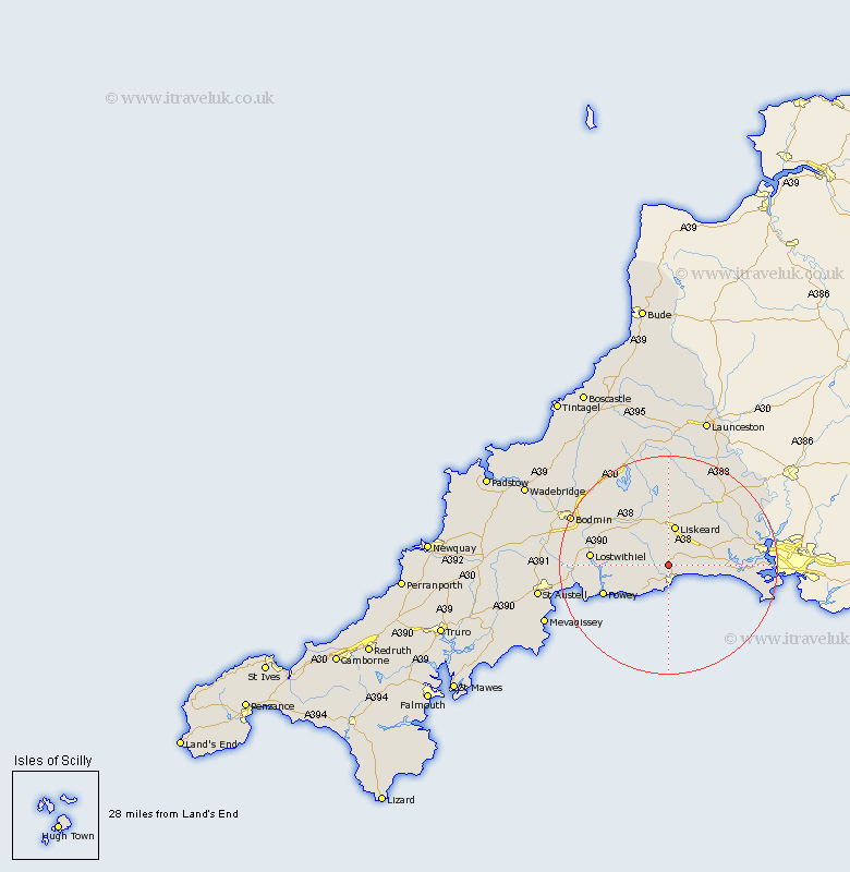
Cornwall Map Showing Location of Sandplace
District: Caradon
Easting: 224657 Northing: 56688
Latitude: 50.38 Longitude: -4.47
 = Sandplace
Easting: 224657 Northing: 56688
Latitude: 50.38 Longitude: -4.47
= Sandplace
This Sandplace map below is supplied by Google. Use the tools in the top left corner to zoom into street level or zoom out for a road map, you may also need to zoom in to see Sandplace on the map. Click and drag the map to move around. If the map fails to load try and refresh your browser or zoom in or out (+ or -).
Update - it seems Google no longer allow people to use their maps for free! This Sandplace map sometimes loads and sometimes gives a error. I am working on a solution.
Closest 30 Towns or Cities to Sandplace (Population over 500)
Duloe 1.18km Morval 1.18km West Looe 3.21km Looe 3.21km Pelynt 5.07km Menheniot 6.59km Lanreath 7.09km Lansallos 7.33km Liskeard 7.51km Dobwalls 8.22km Lanteglos 12.01km Fowey 13.07km Sherviock 13.13km Sheviock 13.13km Lostwithiel 14.3km Tywardreath 15.81km Cardinham 17.1km Cardingham 17.1km Callington 17.54km St Blazey 17.82km St. Blazey 17.82km Saint Blazey 17.82km Saltash 18.1km Par 18.11km Linkinhorne 18.12km North Hill 18.69km Torpoint 19km Bodmin 19.99km Millbrook 20.18km Blisland 21.34km