Herefordshire Map Showing Location of St. Margaret
Easting: 334788 Northing: 233979
Latitude: 52 Longitude: -2.95
 = St. Margaret
Latitude: 52 Longitude: -2.95
= St. Margaret
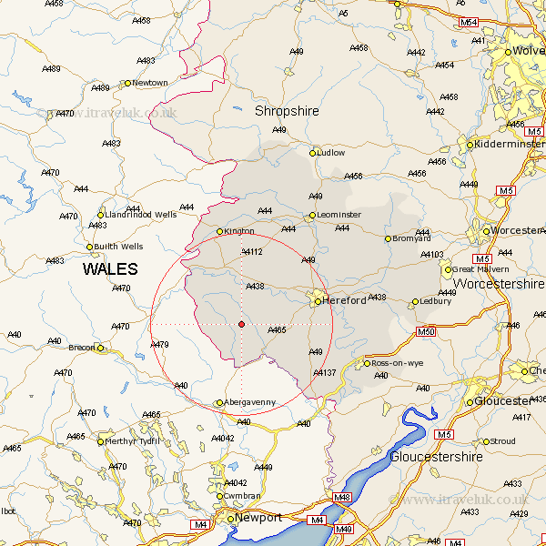
This St. Margaret map below is supplied by Google. Use the tools in the top left corner to zoom into street level or zoom out for a road map, you may also need to zoom in to see St. Margaret on the map. Click and drag the map to move around. If the map fails to load try and refresh your browser or zoom in or out (+ or -).
Update - it seems Google no longer allow people to use their maps for free! This St. Margaret map sometimes loads and sometimes gives a error. I am working on a solution.
Closest 30 Towns or Cities to St. Margaret (Population over 500)
Peterchurch 3.7km Ewyas Harold 7.19km Madley 7.78km Kingstone 8.2km Allensmore 11.56km Much Dewchurch 13.82km Clifford 15.13km Credenhill 15.13km Eardisley 15.21km Bullingham 16.39km Much Birch 16.4km Burghill 16.76km Almeley 16.83km Hereford 16.91km Moreton on Lugg 18.52km Moreton-on-Lugg 18.52km Moreton 18.52km Broad Oak 18.88km Weobley 19.39km Wellington 20.16km Dilwyn 21.16km Sutton 21.36km Lugwardine 21.82km Lyonshall 22.36km Mordiford 22.37km Kington 22.7km Fownhope 23.96km Pembridge 24.34km Withington 24.34km Bodenham 24.71km