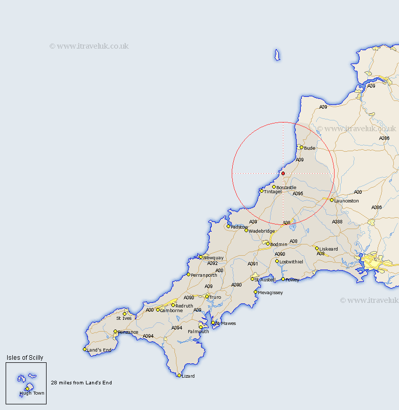
Cornwall Map Showing Location of Saint Gennis
District: North Cornwall
Easting: 214193 Northing: 96002
Latitude: 50.73 Longitude: -4.63
 = Saint Gennis
Easting: 214193 Northing: 96002
Latitude: 50.73 Longitude: -4.63
= Saint Gennis
This Saint Gennis map below is supplied by Google. Use the tools in the top left corner to zoom into street level or zoom out for a road map, you may also need to zoom in to see Saint Gennis on the map. Click and drag the map to move around. If the map fails to load try and refresh your browser or zoom in or out (+ or -).
Update - it seems Google no longer allow people to use their maps for free! This Saint Gennis map sometimes loads and sometimes gives a error. I am working on a solution.
Closest 30 Towns or Cities to Saint Gennis (Population over 500)
Pounstock 6.94km Poundstock 6.94km Forrabury 8.08km Markhamchurch 11.06km Marhamchurch 11.06km Tintagel 11.06km Bude 13.16km Camelford 13.44km North Petherwin 15.14km Altarnun 16.41km Morwenstow 19.44km Moorwinstow 19.44km Kilkhampton 19.73km Lewannick 20.46km Launceston 21.83km South Petherwin 21.87km Blisland 24.34km North Hill 24.79km Lezant 26.02km Cardinham 27.82km Cardingham 27.82km Wadebridge 27.91km Linkinhorne 29.13km Bodmin 30.22km Padstow 30.7km Dobwalls 32.56km St Issey 32.75km St. Issey 32.75km Saint Issey 32.75km Lanivet 32.88km