Herefordshire Map Showing Location of Saint Devereux
Easting: 343899 Northing: 230165
Latitude: 51.97 Longitude: -2.82
 = Saint Devereux
Latitude: 51.97 Longitude: -2.82
= Saint Devereux
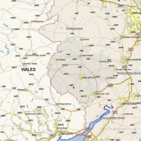
This Saint Devereux map below is supplied by Google. Use the tools in the top left corner to zoom into street level or zoom out for a road map, you may also need to zoom in to see Saint Devereux on the map. Click and drag the map to move around. If the map fails to load try and refresh your browser or zoom in or out (+ or -).
Update - it seems Google no longer allow people to use their maps for free! This Saint Devereux map sometimes loads and sometimes gives a error. I am working on a solution.
Closest 30 Towns or Cities to Saint Devereux (Population over 500)
Much Dewchurch 4.93km Ewyas Harold 4.93km Kingstone 5.68km Allensmore 6.01km Much Birch 6.85km Madley 7.75km Bullingham 10.08km Broad Oak 10.34km Hereford 11.52km Peterchurch 11.75km Credenhill 14.87km Burghill 15.21km Fownhope 15.29km Mordiford 15.6km Moreton 15.88km Moreton on Lugg 15.88km Moreton-on-Lugg 15.88km Lugwardine 15.93km Whitchurch 17.29km Sutton 17.4km Walford 17.51km Goodrich 17.66km Ross on Wye 18.02km Ross-on-wye 18.02km Ross 18.02km Wellington 19.08km Withington 19.42km Weston 20.2km Weston under Penyard 20.2km Weston-under-Penyard 20.2km