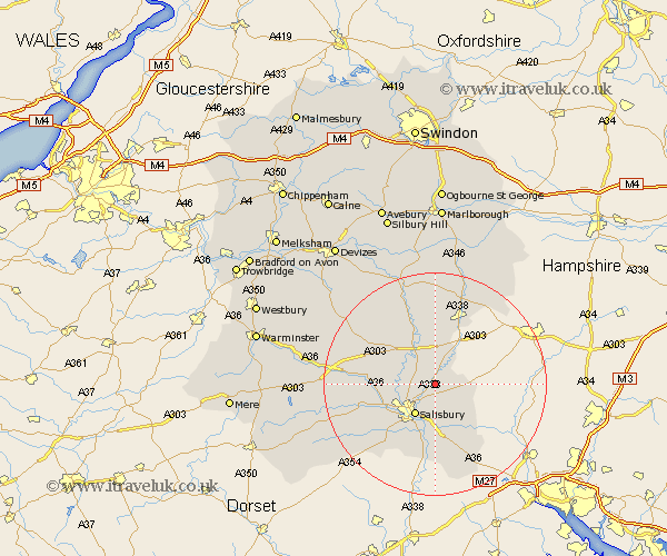
Wiltshire Map Showing Location of Porton
District: Salisbury
Easting: 418663 Northing: 135360
Latitude: 51.12 Longitude: -1.73
 = Porton
Easting: 418663 Northing: 135360
Latitude: 51.12 Longitude: -1.73
= Porton
This Porton map below is supplied by Google. Use the tools in the top left corner to zoom into street level or zoom out for a road map, you may also need to zoom in to see Porton on the map. Click and drag the map to move around. If the map fails to load try and refresh your browser or zoom in or out (+ or -).
Update - it seems Google no longer allow people to use their maps for free! This Porton map sometimes loads and sometimes gives a error. I am working on a solution.
Closest 30 Towns or Cities to Porton (Population over 500)
Idmiston 2.18km Winterbourne 2.19km Winterbourne Dauntsey 2.19km Winterslow 5.95km Amesbury 6.56km New Sarum 6.56km Salisbury 6.56km Durrington 7.76km Farley 8.2km Alderbury 9.27km Lark Hill 9.42km South Newton 9.49km Bulford 9.55km Britford 9.56km Odstock 9.91km Wilton 10.02km Lugershall 10.93km Ludgershall 10.93km Figheldean 11.65km Combebissett 12.35km Coombe Bissett 12.35km Downton 12.98km Netheravon 13.43km Tidworth 13.77km North Tidworth 13.77km Shrewton 13.78km Steeple Langford 14.08km Longford 14.08km Whiteparish 14.22km Redlynch 14.88km