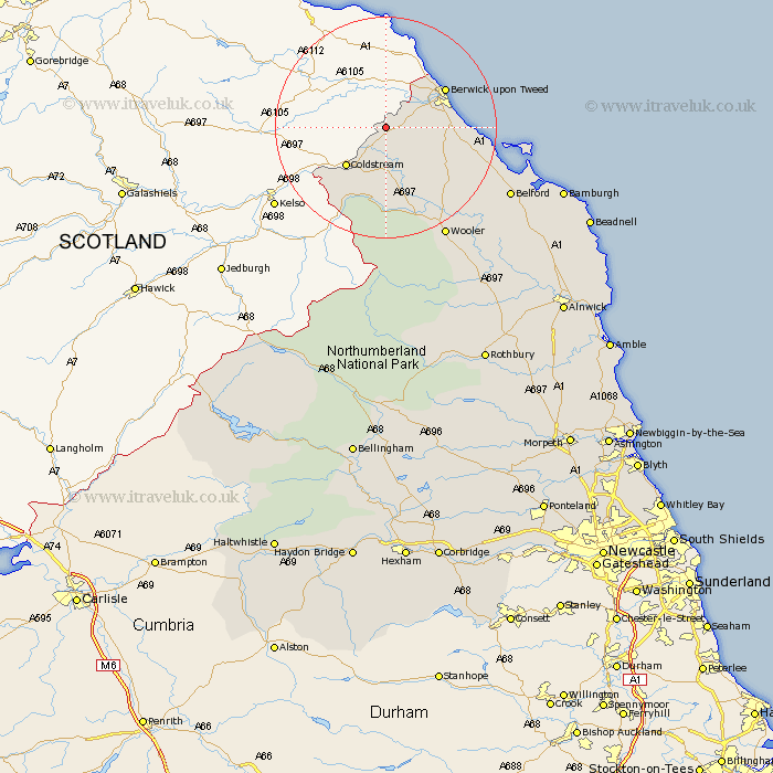
Northumberland Map Showing Location of Norham
Population: 536
District: Berwick-upon-Tweed
Easting: 390577 Northing: 647039
Latitude: 55.72 Longitude: -2.15
 = Norham
District: Berwick-upon-Tweed
Easting: 390577 Northing: 647039
Latitude: 55.72 Longitude: -2.15
= Norham
This Norham map below is supplied by Google. Use the tools in the top left corner to zoom into street level or zoom out for a road map, you may also need to zoom in to see Norham on the map. Click and drag the map to move around. If the map fails to load try and refresh your browser or zoom in or out (+ or -).
Update - it seems Google no longer allow people to use their maps for free! This Norham map sometimes loads and sometimes gives a error. I am working on a solution.
Closest 30 Towns or Cities to Norham (Population over 500)
East Ord 9.13km Ord 9.13km Ancroft 9.58km Berwick upon Tweed 11.96km Berwick-on-Tweed 11.96km Berwick-upon-Tweed 11.96km Berwick 11.96km Berwick on Tweed 11.96km Berwick-Upon-Tweed 11.96km Lowick 14.77km Wooler 22.46km Belford 23.73km North Sunderland 34.61km Beadnell 37.35km Embleton 42.38km Almwick 45.18km Alnwick 45.18km Rothbury 47.18km Shilbottle 48.75km Alnmouth 49.36km Lesbury 50km Lisburg 50km Warkworth 52.81km Swarland 53.25km Longframlington 53.44km Amble 55.58km Otterburn 55.61km Felton 55.91km East Thirston 56.45km Thirston 56.45km