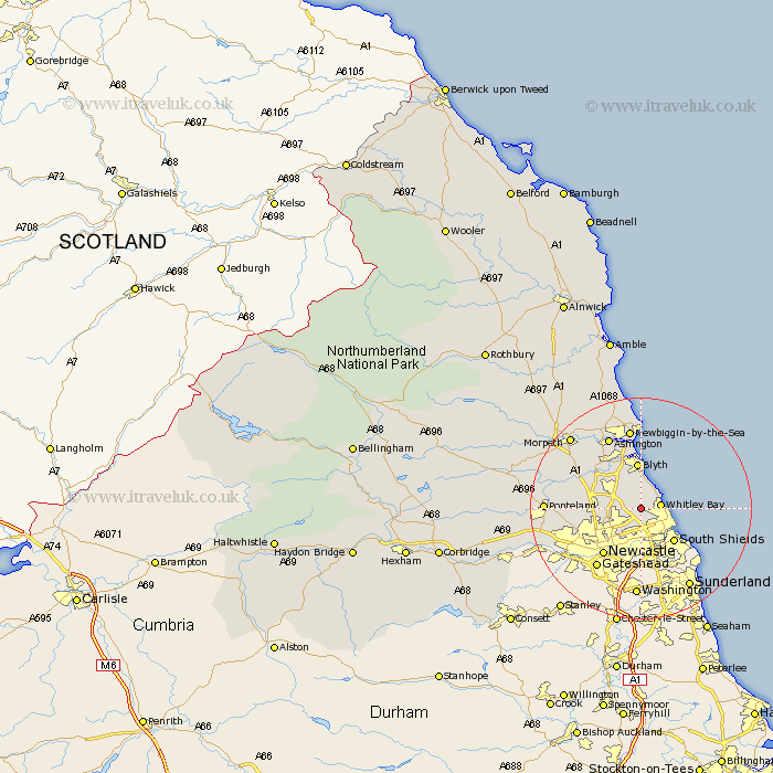
Northumberland Map Showing Location of Monkseaton
District: North Tyneside
Easting: 431625 Northing: 572463
Latitude: 55.05 Longitude: -1.51
 = Monkseaton
Easting: 431625 Northing: 572463
Latitude: 55.05 Longitude: -1.51
= Monkseaton
This Monkseaton map below is supplied by Google. Use the tools in the top left corner to zoom into street level or zoom out for a road map, you may also need to zoom in to see Monkseaton on the map. Click and drag the map to move around. If the map fails to load try and refresh your browser or zoom in or out (+ or -).
Update - it seems Google no longer allow people to use their maps for free! This Monkseaton map sometimes loads and sometimes gives a error. I am working on a solution.
Closest 30 Towns or Cities to Monkseaton (Population over 500)
Seaton Delaval 2.46km Seghill 2.91km Whitley Bay 3.31km Whitley 3.31km Shiremoor 3.88km Killingworth 4.16km Tynemouth 4.5km Seaton Sluice 4.75km North Shields 4.99km Cramlington 5.51km Longbenton 6.42km Long Benton 6.42km Dudley 6.63km Wallsend on Tyne 6.96km Wallsend-on-Tyne 6.96km Wallsend 6.96km South Shields 8.35km Blyth 8.36km Blythe 8.36km Gosforth 8.74km Newcastle 10.66km Newcastle-on-Tyne 10.66km Newcastle on Tyne 10.66km Newcastle upon Tyne 10.66km Bedlington 10.94km Dinnington 11.37km Woolsington 11.81km Stannington 11.94km Ashington 14.14km Newbiggin-by-the-Sea 14.74km