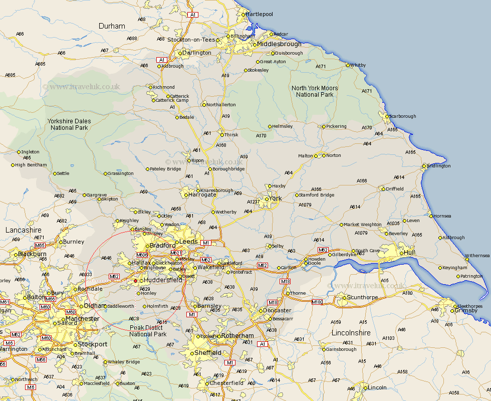
Yorkshire Map Showing Location of Lindley
District: Kirklees
Easting: 412116 Northing: 417096
Latitude: 53.65 Longitude: -1.82
 = Lindley
Easting: 412116 Northing: 417096
Latitude: 53.65 Longitude: -1.82
= Lindley
This Lindley map below is supplied by Google. Use the tools in the top left corner to zoom into street level or zoom out for a road map, you may also need to zoom in to see Lindley on the map. Click and drag the map to move around. If the map fails to load try and refresh your browser or zoom in or out (+ or -).
Update - it seems Google no longer allow people to use their maps for free! This Lindley map sometimes loads and sometimes gives a error. I am working on a solution.
Closest 30 Towns or Cities to Lindley (Population over 500)
Huddersfield 2.2km Elland 3.86km Honley 5.67km Brighouse 5.98km Halifax 7.73km Meltham 7.74km Ripponden 8.98km Mirfield 8.98km Liversedge 9.49km Kirkburton 9.49km Cleckheaton 9.92km Shepley 9.93km Shelley 10.4km Luddenden Foot 10.68km Holme 11.17km Heckmondwike 11.34km Holmfirth 11.6km Emley 12.64km Mytholmroyd 13.25km Denby Dale 13.55km Batley 13.75km Middletown 14.28km Middlestown 14.28km Dewsbury 14.3km Drewsbury 14.3km Queensbury 14.55km Bradford 15.46km Dunford Bridge 15.46km Saddleworth 15.64km Denholme 15.8km