Herefordshire Map Showing Location of Legion Cross
Easting: 341935 Northing: 257994
Latitude: 52.22 Longitude: -2.85
 = Legion Cross
Latitude: 52.22 Longitude: -2.85
= Legion Cross
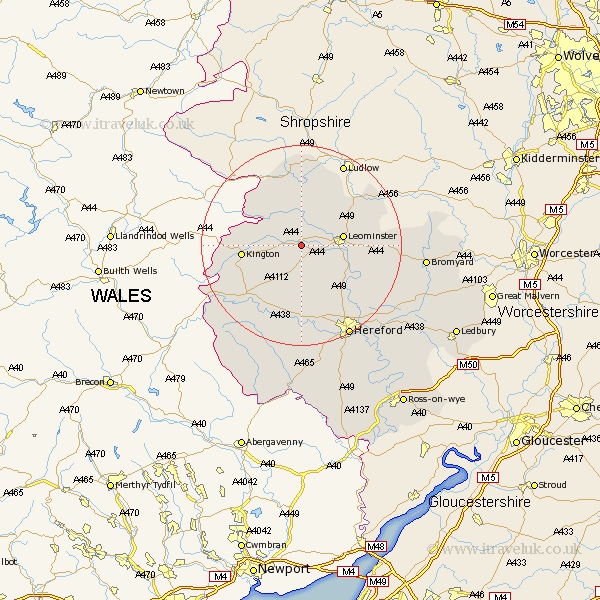
This Legion Cross map below is supplied by Google. Use the tools in the top left corner to zoom into street level or zoom out for a road map, you may also need to zoom in to see Legion Cross on the map. Click and drag the map to move around. If the map fails to load try and refresh your browser or zoom in or out (+ or -).
Update - it seems Google no longer allow people to use their maps for free! This Legion Cross map sometimes loads and sometimes gives a error. I am working on a solution.
Closest 30 Towns or Cities to Legion Cross (Population over 500)
Pembridge 3.41km Shobdon 3.87km Dilwyn 3.88km Kingsland 5.03km Weobley 5.67km Croft 8.15km Leominster 8.16km Luston 8.79km Lyonshall 9.27km Wigmore 11.12km Orleton 11.49km Kington 11.51km Wellington 11.51km Almeley 11.73km Credenhill 13.42km Bodenham 13.57km Brimfield 13.79km Eardisley 13.81km Burghill 14.17km Moreton 15.22km Moreton on Lugg 15.22km Moreton-on-Lugg 15.22km Leintwardine 16.72km Sutton 17.25km Withington 19.67km Madley 20.39km Hereford 20.65km Clifford 21.43km Peterchurch 21.5km Lugwardine 21.55km