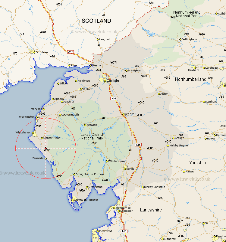
Cumbria Map Showing Location of Hale
District: Copeland
Easting: 303832 Northing: 507095
Latitude: 54.45 Longitude: -3.48
 = Hale
Easting: 303832 Northing: 507095
Latitude: 54.45 Longitude: -3.48
= Hale
This Hale map below is supplied by Google. Use the tools in the top left corner to zoom into street level or zoom out for a road map, you may also need to zoom in to see Hale on the map. Click and drag the map to move around. If the map fails to load try and refresh your browser or zoom in or out (+ or -).
Update - it seems Google no longer allow people to use their maps for free! This Hale map sometimes loads and sometimes gives a error. I am working on a solution.
Closest 30 Towns or Cities to Hale (Population over 500)
Egremont 2.84km Gosforth 6.43km Seascale 7.42km Cleator Moor 7.72km Frizington 9.26km Saint Bees 10.25km St Bega 10.25km St. Bees 10.25km St Bees 10.25km St. Bega 10.25km Saint Bega 10.25km Whitehaven 13.43km Lamplugh 14.05km Parton 14.49km Distington 15.17km Lowca 16.17km Dean 16.99km Bootle 21.74km Brigham 22.65km Workington 22.88km Cockermouth 25.58km Broughton Moor 25.96km Flimby 26.03km Bridekirk 27.01km Maryport 27.82km Dearham 27.98km Conistan 28.51km Coniston 28.51km Koswick 28.95km Keswick 28.95km