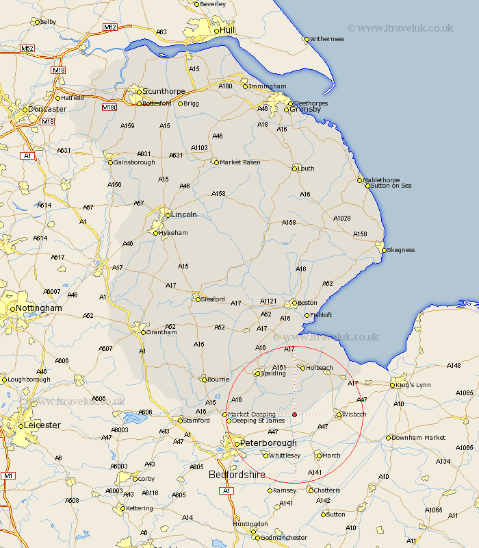
Lincolnshire Map Showing Location of Gedney Hill
Population: 616
District: South Holland
Easting: 534104 Northing: 309549
Latitude: 52.67 Longitude: -0.02
 = Gedney Hill
District: South Holland
Easting: 534104 Northing: 309549
Latitude: 52.67 Longitude: -0.02
= Gedney Hill
This Gedney Hill map below is supplied by Google. Use the tools in the top left corner to zoom into street level or zoom out for a road map, you may also need to zoom in to see Gedney Hill on the map. Click and drag the map to move around. If the map fails to load try and refresh your browser or zoom in or out (+ or -).
Update - it seems Google no longer allow people to use their maps for free! This Gedney Hill map sometimes loads and sometimes gives a error. I am working on a solution.
Closest 30 Towns or Cities to Gedney Hill (Population over 500)
Leverington 7.87km Croyland 8.99km Crowland 8.99km Sutton St. James 9.3km Sutton Saint James 9.3km Sutton St James 9.3km Cowbit 10.01km Whaplode 13.01km Moulton 13.16km Deeping Saint Nicholas 13.55km Deeping St Nicholas 13.55km Deeping St. Nicholas 13.55km Fleet 14.13km Tydd 14.4km Tydd St Mary 14.4km Tydd Saint Mary 14.4km Tydd St. Mary 14.4km Holbeach 14.99km Gedney 15.16km Weston 15.2km Spalding 16.44km Long Sutton 16.44km Pinchbeck 17.33km Lutton 17.33km Sutton Bridge 17.47km Deeping Saint James 18.08km Deeping St James 18.08km Deeping St. James 18.08km Market Deeping 19.11km Surfleet 20.12km