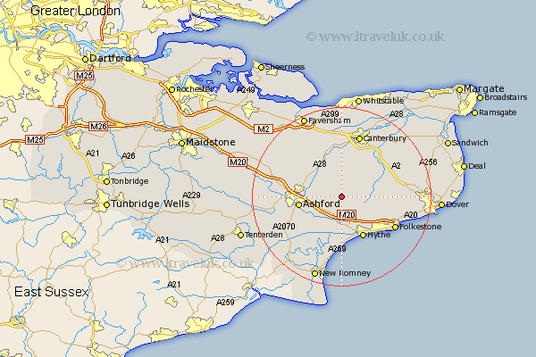
Kent Map Showing Location of Elmsted
Population: 292
District: Shepway
Easting: 610954 Northing: 143356
Latitude: 51.15 Longitude: 1.02
 = Elmsted
District: Shepway
Easting: 610954 Northing: 143356
Latitude: 51.15 Longitude: 1.02
= Elmsted
This Elmsted map below is supplied by Google. Use the tools in the top left corner to zoom into street level or zoom out for a road map, you may also need to zoom in to see Elmsted on the map. Click and drag the map to move around. If the map fails to load try and refresh your browser or zoom in or out (+ or -).
Update - it seems Google no longer allow people to use their maps for free! This Elmsted map sometimes loads and sometimes gives a error. I am working on a solution.
Closest 30 Towns or Cities to Elmsted (Population over 500)
Brabourne 2.19km Stelling 5.09km Smeeth 5.09km Sellinge 5.68km Sellindge 5.68km Lyminge 5.95km Hinxhill 6.1km Wye 6.89km Elham 6.97km Petham 7.77km Mersham 8.05km Aldington 8.76km Kennington 9.3km Lympne 9.34km Ashford 9.49km Lower Hardres 9.9km Chilham 9.9km Hythe 10.37km Chartham 11.12km Bridge 11.59km Swingfield 11.77km Hawkinge 11.85km Kingsnorth 12.89km Folkestone 13.8km Folkstone 13.8km Hothfield 13.95km Rockinge 14.5km Ruckinge 14.5km Canterbury 14.63km Selling 14.73km