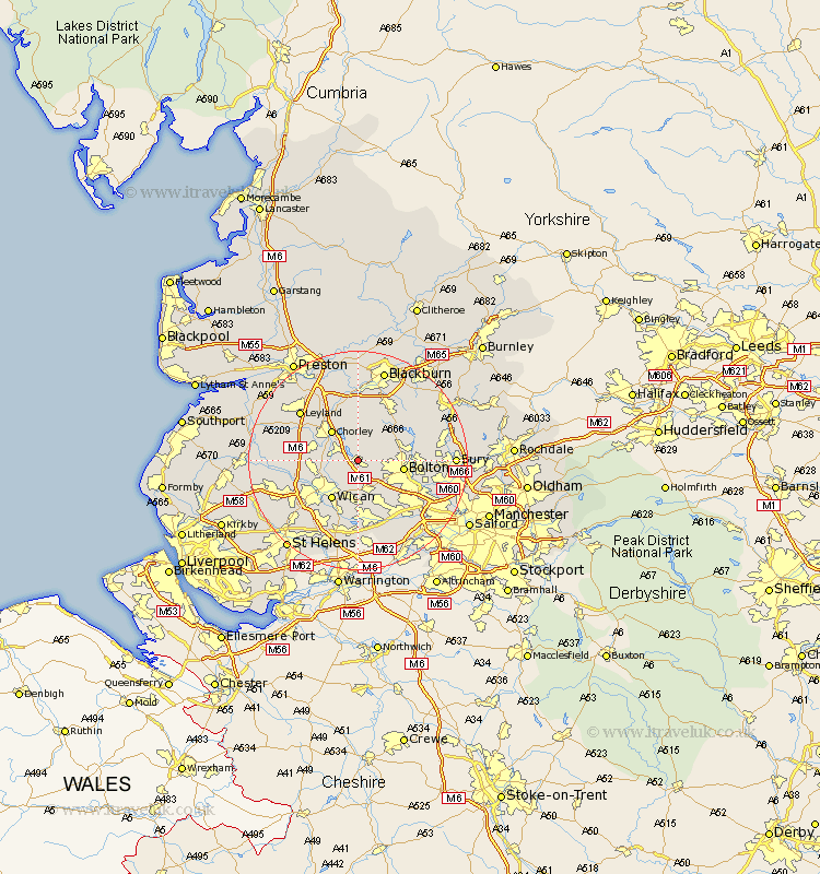
Lancashire Map Showing Location of Horwich
Population: 17658
Area Size (ha): 415
District: Bolton
Easting: 363606 Northing: 411659
Latitude: 53.6 Longitude: -2.55
 = Horwich
Area Size (ha): 415
District: Bolton
Easting: 363606 Northing: 411659
Latitude: 53.6 Longitude: -2.55
= Horwich
This Horwich map below is supplied by Google. Use the tools in the top left corner to zoom into street level or zoom out for a road map, you may also need to zoom in to see Horwich on the map. Click and drag the map to move around. If the map fails to load try and refresh your browser or zoom in or out (+ or -).
Update - it seems Google no longer allow people to use their maps for free! This Horwich map sometimes loads and sometimes gives a error. I am working on a solution.
Closest 30 Towns or Cities to Horwich (Population over 500)
Haigh 2.2km Blackrod 2.88km Adlington 3.3km Westhoughton 5.98km Coppull 6.85km Chorley 7.09km Hindley 7.74km Standish 7.92km Bolton 7.92km Heapey 8.62km Wigan 8.63km Ince-in-Makerfield 8.63km Ince 8.63km Brinscall 9.33km Euxton 9.49km Abram 9.52km Shevington 9.55km Atherton 9.83km Bromley Cross 9.9km Bradshaw 9.9km Turton 10.56km Tyldesley 10.77km Withnell 11.12km Farnworth 11.36km Eccleston 11.6km Appley Bridge 11.61km Darwen 12.4km Leigh 13.16km Hoghton 13.16km Kearsley 13.27km