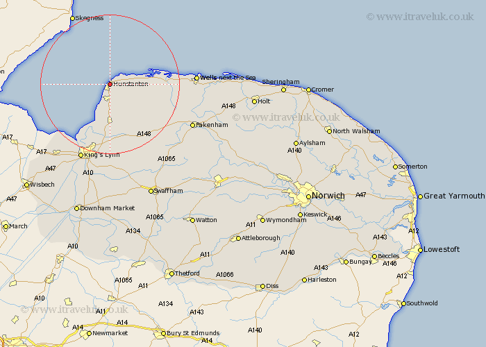
Norfolk Map Showing Location of Hunstanton
Population: 4651
Area Size (ha): 236
District: King's Lynn and West Norfolk
Easting: 567938 Northing: 342139
Latitude: 52.95 Longitude: 0.5
 = Hunstanton
Area Size (ha): 236
District: King's Lynn and West Norfolk
Easting: 567938 Northing: 342139
Latitude: 52.95 Longitude: 0.5
= Hunstanton
This Hunstanton map below is supplied by Google. Use the tools in the top left corner to zoom into street level or zoom out for a road map, you may also need to zoom in to see Hunstanton on the map. Click and drag the map to move around. If the map fails to load try and refresh your browser or zoom in or out (+ or -).
Update - it seems Google no longer allow people to use their maps for free! This Hunstanton map sometimes loads and sometimes gives a error. I am working on a solution.
Closest 30 Towns or Cities to Hunstanton (Population over 500)
Heacham 3.87km Sedgeford 6.49km Snettisham 9.26km Ingoldesthorpe 9.33km Ingoldisthorpe 9.33km Docking 9.6km Brancaster 10.22km Dersingham 11.12km Great Bircham 14.27km Bircham 14.27km Burnham Market 15.63km Syderstone 18.3km North Wootton 19.07km South Creake 19.36km Tattersett 20.33km Tatterset 20.33km Grimston 20.66km East Rudham 20.76km South Wootton 20.87km Great Massingham 23.25km Massingham 23.25km Wells on Sea 23.52km Wells-on-Sea 23.52km Wells-next-the-Sea 23.52km Wells next the Sea 23.52km Wells 23.52km King's Lynn 23.58km Kings Lynn 23.58km Lynn Regis 23.58km Lynn 23.58km