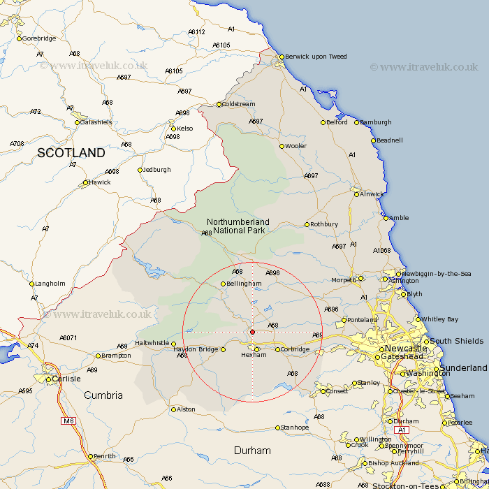
Northumberland Map Showing Location of Chollerford
District: Tynedale
Easting: 392540 Northing: 569142
Latitude: 55.02 Longitude: -2.12
 = Chollerford
Easting: 392540 Northing: 569142
Latitude: 55.02 Longitude: -2.12
= Chollerford
This Chollerford map below is supplied by Google. Use the tools in the top left corner to zoom into street level or zoom out for a road map, you may also need to zoom in to see Chollerford on the map. Click and drag the map to move around. If the map fails to load try and refresh your browser or zoom in or out (+ or -).
Update - it seems Google no longer allow people to use their maps for free! This Chollerford map sometimes loads and sometimes gives a error. I am working on a solution.
Closest 30 Towns or Cities to Chollerford (Population over 500)
Humshaugh 2.13km Chollerton 2.13km Challerton 2.13km Warden 3.86km Acomb 3.86km Newbrough 4.64km Sandhoe 5.65km Hexham 5.66km Wark 8.46km Corbridge 8.46km Haydon Bridge 9.29km Riding 13.33km Ridingmill 13.33km Slaley 14.03km Stocksfield 15.78km Stamfordham 16.04km Bellingham 16.58km Ovingham 16.89km Wylam 17.9km Prudhoe 18.56km Haltwhistle 20.54km Otterburn 22.46km Ponteland 23.66km Newburn 25.08km Woolsington 27.63km Dinnington 27.86km Stannington 30.12km Gosforth 31.94km Morpeth 32.23km Longhorsley 32.79km