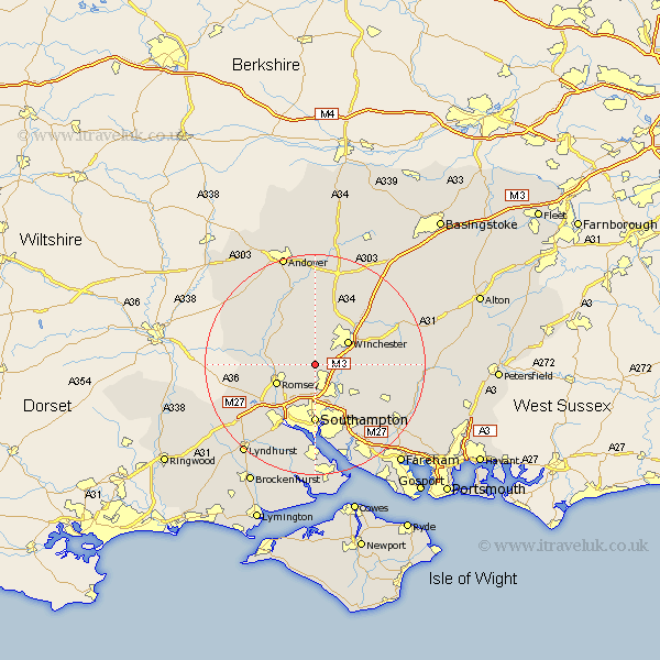
Hampshire Map Showing Location of Hursley
Population: 838
District: Winchester
Easting: 442082 Northing: 124378
Latitude: 51.02 Longitude: -1.4
 = Hursley
District: Winchester
Easting: 442082 Northing: 124378
Latitude: 51.02 Longitude: -1.4
= Hursley
This Hursley map below is supplied by Google. Use the tools in the top left corner to zoom into street level or zoom out for a road map, you may also need to zoom in to see Hursley on the map. Click and drag the map to move around. If the map fails to load try and refresh your browser or zoom in or out (+ or -).
Update - it seems Google no longer allow people to use their maps for free! This Hursley map sometimes loads and sometimes gives a error. I am working on a solution.
Closest 30 Towns or Cities to Hursley (Population over 500)
Otterbourne 3.96km Compton 4.66km Sparsholt 5.68km Twyford 5.83km Eastleigh 6.57km Michlemersh 7.23km Michelmersh 7.23km Bishopstoke 7.26km Winchester 7.33km Chilworth 7.51km Romsey 7.92km Kings Somborne 8.05km Owslebury 9.51km Kings Worthy 10.18km Southampton 10.75km Stockbridge 10.94km West End 12.06km Totton 12.56km Broughton 12.84km Durley 12.86km Upham 12.92km Itchen 13.03km Sherfield English 13.36km West Wellow 13.98km Eling 14.23km Botley 14.52km Bishops Waltham 14.82km Bishop's Waltham 14.82km Chilbolton 15km Marchwood 15.01km