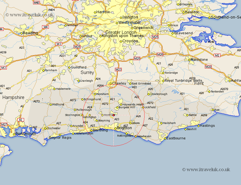
Sussex Map Showing Location of Hurstpierpoint
Population: 11832
Area Size (ha): 314
District: Mid Sussex
Easting: 528857 Northing: 114688
Latitude: 50.92 Longitude: -0.17
 = Hurstpierpoint
Area Size (ha): 314
District: Mid Sussex
Easting: 528857 Northing: 114688
Latitude: 50.92 Longitude: -0.17
= Hurstpierpoint
This Hurstpierpoint map below is supplied by Google. Use the tools in the top left corner to zoom into street level or zoom out for a road map, you may also need to zoom in to see Hurstpierpoint on the map. Click and drag the map to move around. If the map fails to load try and refresh your browser or zoom in or out (+ or -).
Update - it seems Google no longer allow people to use their maps for free! This Hurstpierpoint map sometimes loads and sometimes gives a error. I am working on a solution.
Closest 30 Towns or Cities to Hurstpierpoint (Population over 500)
Albourne 2.19km Keymer 2.34km Hassocks 2.34km Ditchelling 4.67km Ditchling 4.67km Burgess Hill 6.03km Wivelsfield 6.92km Henfield 7.01km Botney 7.76km Bolney 7.76km Baywards Heath 8.76km Haywards Heath 8.76km Plumpton 8.99km Hove 9.35km Brighton 9.35km Portslade 9.92km Southwick 9.92km Cowfold 10.19km Shoreham by Sea 10.38km New Shoreham 10.38km Shoreham-by-Sea 10.38km Shoreham 10.38km Steyning 11.15km Bramber 11.16km Upper Bleeding 11.16km Upper Beeding 11.16km South Nutfield 11.36km Cuckfield 11.36km Lindfield 11.61km Lewes 11.9km