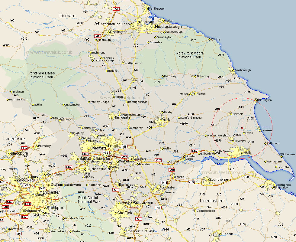
Yorkshire Map Showing Location of Burshill
Easting: 509451 Northing: 448037
Latitude: 53.92 Longitude: -0.33
 = Burshill
Latitude: 53.92 Longitude: -0.33
= Burshill
This Burshill map below is supplied by Google. Use the tools in the top left corner to zoom into street level or zoom out for a road map, you may also need to zoom in to see Burshill on the map. Click and drag the map to move around. If the map fails to load try and refresh your browser or zoom in or out (+ or -).
Update - it seems Google no longer allow people to use their maps for free! This Burshill map sometimes loads and sometimes gives a error. I am working on a solution.
Closest 30 Towns or Cities to Burshill (Population over 500)
Brandesburton 2.18km Brandsburton 2.18km Leven 3.87km Tickton 6.45km Dunnington 6.59km Beeford 7.07km Cranswick 7.52km Skipsea 9.45km Leconfield 9.45km Leckonfield 9.45km Lockington 10km Beverley 10.76km Hornsea 11.07km North Frodingham 11.28km Nafferton 11.59km Woodmansey 11.6km Driffield 11.96km Cherry Burton 12.25km Skirlaugh Station 12.39km Wawne 13.02km Bishop Burton 14.33km Sutton on Hull 14.87km Sutton 14.87km Sutton-on-Hull 14.87km Kilham 14.98km Cottingham 15.19km Skidby 17.22km Hull 17.79km Sproatley 17.8km Wetwang 17.86km