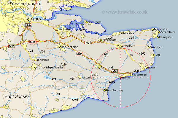
Kent Map Showing Location of Hythe
Population: 14200
Area Size (ha): 493
District: Shepway
Easting: 616003 Northing: 134289
Latitude: 51.07 Longitude: 1.08
 = Hythe
Area Size (ha): 493
District: Shepway
Easting: 616003 Northing: 134289
Latitude: 51.07 Longitude: 1.08
= Hythe
This Hythe map below is supplied by Google. Use the tools in the top left corner to zoom into street level or zoom out for a road map, you may also need to zoom in to see Hythe on the map. Click and drag the map to move around. If the map fails to load try and refresh your browser or zoom in or out (+ or -).
Update - it seems Google no longer allow people to use their maps for free! This Hythe map sometimes loads and sometimes gives a error. I am working on a solution.
Closest 30 Towns or Cities to Hythe (Population over 500)
Lympne 3.49km Lyminge 5.56km Hawkinge 6.9km Sellinge 6.9km Sellindge 6.9km Folkestone 7.23km Folkstone 7.23km Dymchurch 8.05km Brabourne 9.42km Aldington 9.5km Elham 9.55km Smeeth 9.86km Swingfield 10.18km Mersham 11.11km Alkham 12.83km Hinxhill 12.83km Stelling 13.02km New Romney 14km Rockinge 14.1km Ruckinge 14.1km River 14.79km Lydden 14.87km Ewell 15.8km Temple Ewell 15.8km Ashford 15.81km Coldred 16.09km Orlestone 16.3km Ham Street 16.41km Sibertswold 16.66km Shepherdswell 16.66km