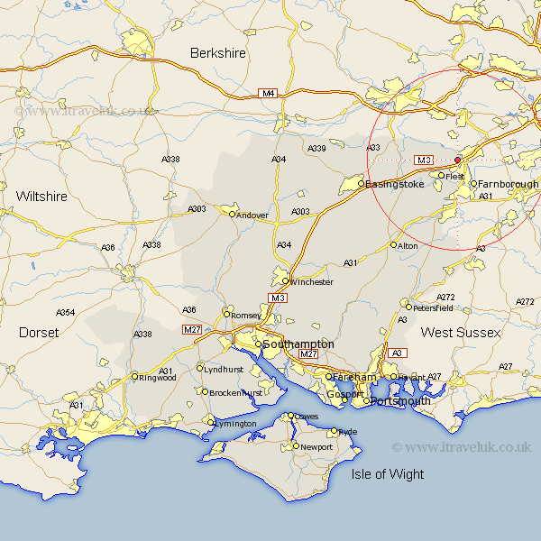
Hampshire Map Showing Location of Blackwater
Population: 5849
District: Hart
Easting: 484781 Northing: 158268
Latitude: 51.32 Longitude: -0.78
 = Blackwater
District: Hart
Easting: 484781 Northing: 158268
Latitude: 51.32 Longitude: -0.78
= Blackwater
This Blackwater map below is supplied by Google. Use the tools in the top left corner to zoom into street level or zoom out for a road map, you may also need to zoom in to see Blackwater on the map. Click and drag the map to move around. If the map fails to load try and refresh your browser or zoom in or out (+ or -).
Update - it seems Google no longer allow people to use their maps for free! This Blackwater map sometimes loads and sometimes gives a error. I am working on a solution.
Closest 30 Towns or Cities to Blackwater (Population over 500)
Fleet 5.09km Farnborough 6.56km Hartley Wintney 7.19km Aldershot 7.51km Winchfield 8.9km Crondall 12.05km Odiham 12.8km Hook 12.85km Rotherwick 13.28km Long Sutton 15.25km Bentley 15.93km Sherfield 16.33km Sherfield upon Loddon 16.33km Basing 18.25km Upton Grey 18.73km Froyle 19.09km Bramley 19.69km Binsted 19.8km Silchester 20.03km Basingstoke 21.59km Headley 22.36km Bordon Camp 22.72km Bordon 22.72km Kingsley 22.98km Tadley 24.6km Alton 24.7km Bramshot 25.98km Baughurst 26.7km Liphook 27.82km Upper Farringdon 27.83km