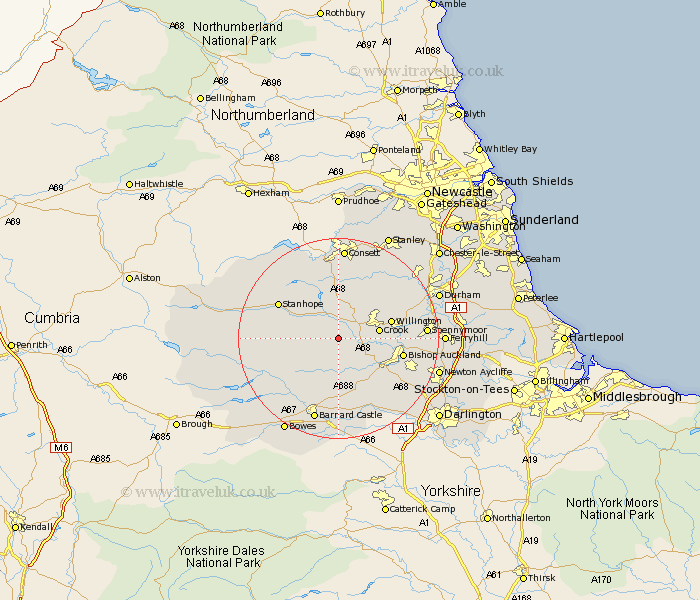
Durham Map Showing Location of Bedburn
Population: 176
District: Teesdale
Easting: 409669 Northing: 532049
Latitude: 54.68 Longitude: -1.85
 = Bedburn
District: Teesdale
Easting: 409669 Northing: 532049
Latitude: 54.68 Longitude: -1.85
= Bedburn
This Bedburn map below is supplied by Google. Use the tools in the top left corner to zoom into street level or zoom out for a road map, you may also need to zoom in to see Bedburn on the map. Click and drag the map to move around. If the map fails to load try and refresh your browser or zoom in or out (+ or -).
Update - it seems Google no longer allow people to use their maps for free! This Bedburn map sometimes loads and sometimes gives a error. I am working on a solution.
Closest 30 Towns or Cities to Bedburn (Population over 500)
Wolsingham 4.29km Tow Law 5.96km High Etherley 7.42km Etherley 7.42km Crook 7.72km Cockfield 8.07km Evenwood 9.14km West Auckland 9.34km Willington 10.33km Cornsay 12.34km Bishop Auckland 12.36km Coundon 12.99km Stanhope 13.02km Staindrop 13.36km Shildon 14.01km Esh 14.71km Cotherstone 15.55km Spennymoor 16.17km Lanchester 16.62km Gainford 16.62km Castleside 16.71km Brandon 16.72km Middleton in Teesdale 16.74km Ushaw Moor 16.99km Startforth 17.22km Barnard Castle 17.22km Langley Park 17.52km Consetti 18.57km Consett 18.57km Witton Gilbert 19.02km