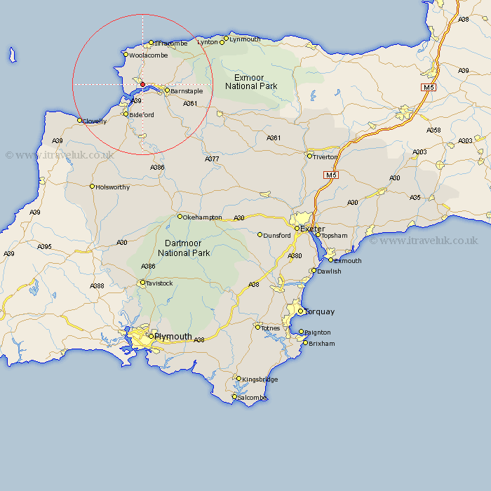
Devon Map Showing Location of Wrafton
District: North Devon
Easting: 249481 Northing: 135667
Latitude: 51.1 Longitude: -4.15
 = Wrafton
Easting: 249481 Northing: 135667
Latitude: 51.1 Longitude: -4.15
= Wrafton
This Wrafton map below is supplied by Google. Use the tools in the top left corner to zoom into street level or zoom out for a road map, you may also need to zoom in to see Wrafton on the map. Click and drag the map to move around. If the map fails to load try and refresh your browser or zoom in or out (+ or -).
Update - it seems Google no longer allow people to use their maps for free! This Wrafton map sometimes loads and sometimes gives a error. I am working on a solution.
Closest 30 Towns or Cities to Wrafton (Population over 500)
Braunton 2.33km Fremington 4.37km Marwood 5.01km Georgeham 5.09km Instow 5.68km Appledore 6.57km Barnstaple 7.23km West Down 7.77km Northam 8.75km Tawstock 8.93km Mortehoe 9.9km Morthoe 9.9km Bideford 10.37km Berrynarbor 12.55km Iltracombe 13.18km Ilfracombe 13.18km Combe Martin 13.78km Swimbridge 13.96km Bratton Fleming 14.09km Buckland Brewer 16.39km Torrington 16.68km Great Torrington 16.68km Chittlehampton 16.77km High Bickington 18.16km Parkham 18.16km Langtree 20.68km Woolsery 22.04km Woolfardisworthy 22.04km Burrington 23.22km Barrington 23.22km