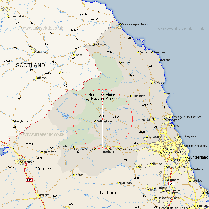
Northumberland Map Showing Location of Woodburn
District: Tynedale
Easting: 389383 Northing: 585839
Latitude: 55.17 Longitude: -2.17
 = Woodburn
Easting: 389383 Northing: 585839
Latitude: 55.17 Longitude: -2.17
= Woodburn
This Woodburn map below is supplied by Google. Use the tools in the top left corner to zoom into street level or zoom out for a road map, you may also need to zoom in to see Woodburn on the map. Click and drag the map to move around. If the map fails to load try and refresh your browser or zoom in or out (+ or -).
Update - it seems Google no longer allow people to use their maps for free! This Woodburn map sometimes loads and sometimes gives a error. I am working on a solution.
Closest 30 Towns or Cities to Woodburn (Population over 500)
Bellingham 4.62km Otterburn 5.56km Wark 11.57km Humshaugh 14.98km Challerton 15.43km Chollerton 15.43km Newbrough 18.57km Warden 20.5km Acomb 20.83km Sandhoe 21.7km Haydon Bridge 22.64km Hexham 22.64km Rothbury 23.75km Stamfordham 24.17km Corbridge 24.2km Longhorsley 26.44km Haltwhistle 26.53km Longframlington 27.55km Ridingmill 28.91km Riding 28.91km Ovingham 29.32km Ponteland 29.51km Wylam 30.02km Stocksfield 30.45km Morpeth 30.7km Hebron 30.75km Slaley 30.85km Swarland 31.22km Prudhoe 31.42km Felton 32.31km