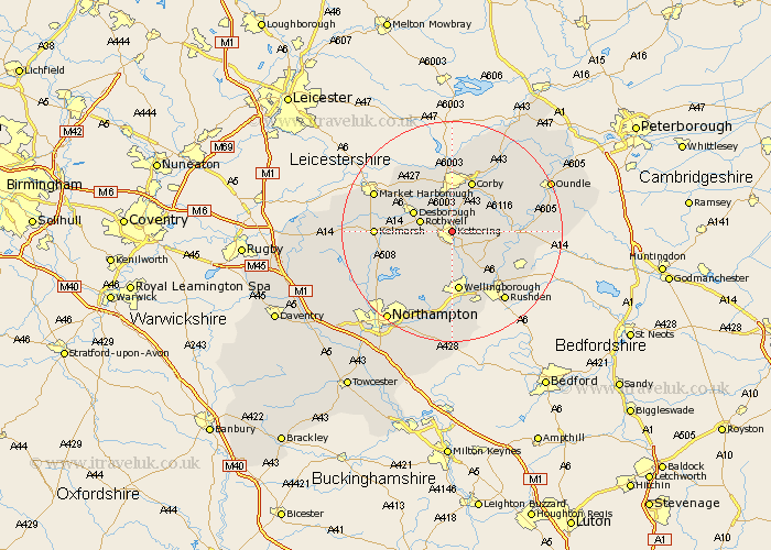
Northamptonshire Map Showing Location of Kettering
Population: 46962
Area Size (ha): 1123
District: Kettering
Easting: 487303 Northing: 278815
Latitude: 52.4 Longitude: -0.72
 = Kettering
Area Size (ha): 1123
District: Kettering
Easting: 487303 Northing: 278815
Latitude: 52.4 Longitude: -0.72
= Kettering
This Kettering map below is supplied by Google. Use the tools in the top left corner to zoom into street level or zoom out for a road map, you may also need to zoom in to see Kettering on the map. Click and drag the map to move around. If the map fails to load try and refresh your browser or zoom in or out (+ or -).
Update - it seems Google no longer allow people to use their maps for free! This Kettering map sometimes loads and sometimes gives a error. I am working on a solution.
Closest 30 Towns or Cities to Kettering (Population over 500)
Kettering 0km Geddington 4.34km Broughton 5.02km Isham 5.67km Rothwell 5.95km Rowell 5.95km Burton Latimer 6.51km Desborough 7.73km Stanion 8.69km Finedon 9.33km Cottingham 9.53km Brigstock 9.67km Corby 9.86km Walgrave 10.05km Woodford 10.84km Wilbarston 10.85km Weldon 10.85km Wellingborough 11.18km Irthlingborough 12.19km Thrapston 12.44km Islip 12.58km Ringstead 12.61km Caldecott 12.98km Sywell 13.74km Higham Ferrers 14.34km Raunds 14.49km Stanwick 14.63km Overstone 14.65km Wilby 14.82km Great Doddington 14.87km