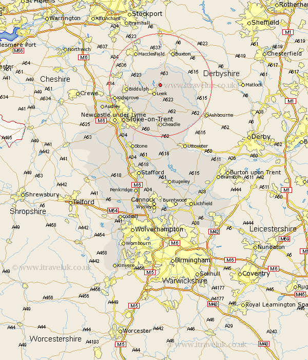
Staffordshire Map Showing Location of Upper Hulme
District: Staffordshire Moorlands
Easting: 401115 Northing: 359603
Latitude: 53.13 Longitude: -1.98
 = Upper Hulme
Easting: 401115 Northing: 359603
Latitude: 53.13 Longitude: -1.98
= Upper Hulme
This Upper Hulme map below is supplied by Google. Use the tools in the top left corner to zoom into street level or zoom out for a road map, you may also need to zoom in to see Upper Hulme on the map. Click and drag the map to move around. If the map fails to load try and refresh your browser or zoom in or out (+ or -).
Update - it seems Google no longer allow people to use their maps for free! This Upper Hulme map sometimes loads and sometimes gives a error. I am working on a solution.
Closest 30 Towns or Cities to Upper Hulme (Population over 500)
Leek 4.32km Horton 6.92km Cheddleton 9.85km Endon 10.49km Ipstones 11.18km Biddulph 12.37km Kingsley 12.96km Waterhouses 13.58km Oakamoor 15.48km Cheadle 16.68km Caverswall 17.58km Kidsgrove 17.59km Draycott in the Moors 18.82km Draycott 18.82km Alton 19.69km Stoke upon Trent 19.96km Stoke 19.96km Stoke-upon-Trent 19.96km Stoke on Trent 19.96km Stoke-on-Trent 19.96km Denston 20.56km Denstone 20.56km Mayfield 20.72km Fulford 21.13km Newcastle under Lyme 22.33km Newcastle-under-Lyme 22.33km Checkley 22.35km Rocester 22.72km Audley 23.09km Barlaston 23.78km