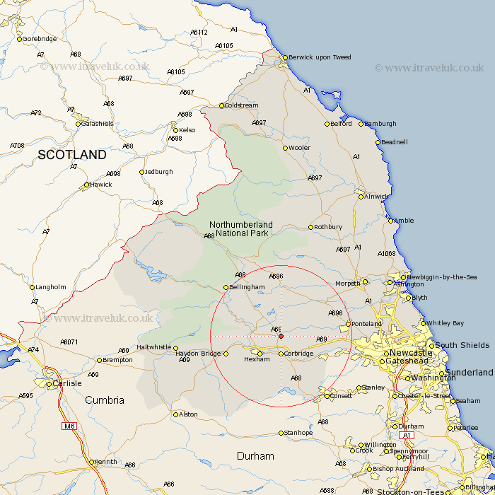
Northumberland Map Showing Location of Stagshaw Bank
District: Tynedale
Easting: 398934 Northing: 569135
Latitude: 55.02 Longitude: -2.02
 = Stagshaw Bank
Easting: 398934 Northing: 569135
Latitude: 55.02 Longitude: -2.02
= Stagshaw Bank
This Stagshaw Bank map below is supplied by Google. Use the tools in the top left corner to zoom into street level or zoom out for a road map, you may also need to zoom in to see Stagshaw Bank on the map. Click and drag the map to move around. If the map fails to load try and refresh your browser or zoom in or out (+ or -).
Update - it seems Google no longer allow people to use their maps for free! This Stagshaw Bank map sometimes loads and sometimes gives a error. I am working on a solution.
Closest 30 Towns or Cities to Stagshaw Bank (Population over 500)
Sandhoe 4.28km Corbridge 5.56km Challerton 5.62km Chollerton 5.62km Acomb 6.48km Humshaugh 7.66km Hexham 7.69km Warden 8.32km Stamfordham 9.74km Riding 9.81km Ridingmill 9.81km Newbrough 10.79km Ovingham 11.07km Stocksfield 11.26km Wylam 12km Prudhoe 12.96km Slaley 13.02km Wark 13.9km Haydon Bridge 14.9km Ponteland 17.39km Newburn 18.91km Bellingham 20.25km Woolsington 21.25km Dinnington 21.56km Stannington 24.14km Otterburn 24.2km Gosforth 25.57km Haltwhistle 26.83km Morpeth 26.98km Newcastle on Tyne 27.16km