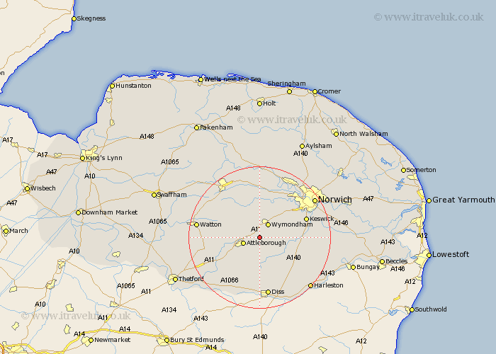
Norfolk Map Showing Location of Spooner Row
District: South Norfolk
Easting: 609101 Northing: 297333
Latitude: 52.53 Longitude: 1.08
 = Spooner Row
Easting: 609101 Northing: 297333
Latitude: 52.53 Longitude: 1.08
= Spooner Row
This Spooner Row map below is supplied by Google. Use the tools in the top left corner to zoom into street level or zoom out for a road map, you may also need to zoom in to see Spooner Row on the map. Click and drag the map to move around. If the map fails to load try and refresh your browser or zoom in or out (+ or -).
Update - it seems Google no longer allow people to use their maps for free! This Spooner Row map sometimes loads and sometimes gives a error. I am working on a solution.
Closest 30 Towns or Cities to Spooner Row (Population over 500)
Besthorpe 3.85km Wymondham 4.35km Attleborough 4.87km Old Buckenham 6km Bunwell 6.51km Ashwellthorpe 6.76km Great Ellingham 7.89km Forncett Saint Mary 8.72km Forncett St Mary 8.72km Forncett 8.72km Forncett St. Mary 8.72km Hingham 8.75km Banham 9.86km Moulton St. Michael 10.03km Moulton St Michael 10.03km Great Moulton 10.03km Moulton Saint Michael 10.03km Moulton 10.03km Hethersett 10.03km Mulbarton 10.31km Rockland 11.27km Rockland St Peter 11.27km Rockland Saint Peter 11.27km Rockland St. Peter 11.27km Quidenham 11.47km Long Stratton 11.57km Swardeston 11.87km Saxlingham 12.4km Saxlingham Thorpe 12.4km Kenninghall 13.02km