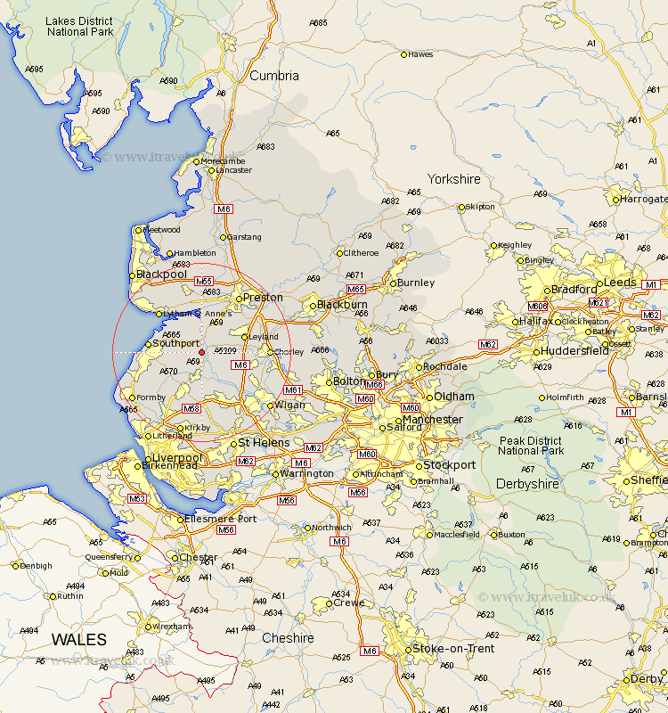
Lancashire Map Showing Location of Sollom
District: West Lancashire
Easting: 344924 Northing: 417403
Latitude: 53.65 Longitude: -2.83
 = Sollom
Easting: 344924 Northing: 417403
Latitude: 53.65 Longitude: -2.83
= Sollom
This Sollom map below is supplied by Google. Use the tools in the top left corner to zoom into street level or zoom out for a road map, you may also need to zoom in to see Sollom on the map. Click and drag the map to move around. If the map fails to load try and refresh your browser or zoom in or out (+ or -).
Update - it seems Google no longer allow people to use their maps for free! This Sollom map sometimes loads and sometimes gives a error. I am working on a solution.
Closest 30 Towns or Cities to Sollom (Population over 500)
Tarleton 1.86km Bretherton 2.88km Rufford 3.7km Croston 4.39km Mawdesley 5.75km Hoole 5.98km Much Hoole 5.98km Penrith 6.59km Banks 6.62km Burscough 7.41km Longton 7.74km Eccleston 7.91km Parbold 8.62km Scarisbrick 8.63km Lathom 9.33km Leyland 9.53km Hutton 10.25km Ormskirk 10.25km Halsall 10.69km Euxton 10.98km Southport 11.14km Freckleton 11.33km Farrington 11.49km Farington 11.49km Appley Bridge 12.04km Coppull 12.64km Lytham Saint Anne's 12.76km Lytham St. Anne's 12.76km Lytham 12.76km Lytham St Anne's 12.76km