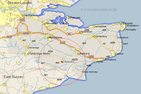
Kent Map Showing Location of Saint Michaels
District: Ashford
Easting: 587985 Northing: 133192
Latitude: 51.07 Longitude: 0.68
 = Saint Michaels
Easting: 587985 Northing: 133192
Latitude: 51.07 Longitude: 0.68
= Saint Michaels
This Saint Michaels map below is supplied by Google. Use the tools in the top left corner to zoom into street level or zoom out for a road map, you may also need to zoom in to see Saint Michaels on the map. Click and drag the map to move around. If the map fails to load try and refresh your browser or zoom in or out (+ or -).
Update - it seems Google no longer allow people to use their maps for free! This Saint Michaels map sometimes loads and sometimes gives a error. I am working on a solution.
Closest 30 Towns or Cities to Saint Michaels (Population over 500)
Tenterden 1.17km High Halden 2.97km Biddenden 5.09km Rolvenden 5.1km Woodchurch 5.82km Benenden 7.23km Beneden 7.23km Smarden 7.41km Wittersham 7.51km Bethersden 8.05km Sandhurst 9.87km Shadoxhurst 10.02km Frittenden 10.18km Headcorn 10.37km Cranbrook 10.64km Orlestone 11.65km Ham Street 11.8km Kingsnorth 12.22km Hothfield 13.13km Hawkhurst 13.34km Egerton 13.43km Pluckley 13.77km Staplehurst 13.98km Rockinge 14.1km Ruckinge 14.1km Ulcombe 15km Ashford 15.81km Sutton Valence 16.38km Goudhurst 16.71km Kennington 16.76km