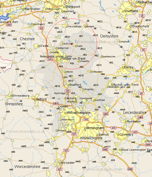
Staffordshire Map Showing Location of Rudyard
District: Staffordshire Moorlands
Easting: 395538 Northing: 357759
Latitude: 53.12 Longitude: -2.07
 = Rudyard
Easting: 395538 Northing: 357759
Latitude: 53.12 Longitude: -2.07
= Rudyard
This Rudyard map below is supplied by Google. Use the tools in the top left corner to zoom into street level or zoom out for a road map, you may also need to zoom in to see Rudyard on the map. Click and drag the map to move around. If the map fails to load try and refresh your browser or zoom in or out (+ or -).
Update - it seems Google no longer allow people to use their maps for free! This Rudyard map sometimes loads and sometimes gives a error. I am working on a solution.
Closest 30 Towns or Cities to Rudyard (Population over 500)
Horton 1.11km Leek 3.82km Endon 4.99km Biddulph 6.67km Cheddleton 7.74km Ipstones 11.43km Kidsgrove 11.73km Kingsley 12.44km Caverswall 14.83km Stoke upon Trent 15.14km Stoke 15.14km Stoke-upon-Trent 15.14km Stoke on Trent 15.14km Stoke-on-Trent 15.14km Cheadle 15.85km Waterhouses 16.26km Oakamoor 16.4km Draycott 16.83km Draycott in the Moors 16.83km Newcastle under Lyme 17.1km Newcastle-under-Lyme 17.1km Audley 17.26km Silverdale 18.25km Fulford 18.54km Keele 19.44km Barlaston 19.71km Alton 20.7km Checkley 21.83km Madeley 22.04km Betley 22.08km