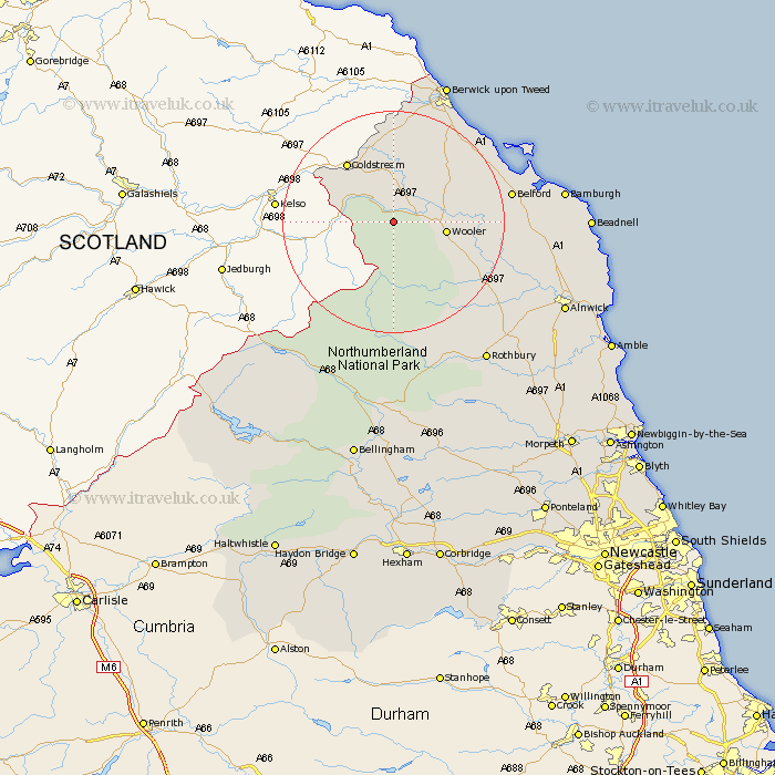
Northumberland Map Showing Location of Kirknewton
Population: 108
District: Berwick-upon-Tweed
Easting: 391588 Northing: 628545
Latitude: 55.55 Longitude: -2.13
 = Kirknewton
District: Berwick-upon-Tweed
Easting: 391588 Northing: 628545
Latitude: 55.55 Longitude: -2.13
= Kirknewton
This Kirknewton map below is supplied by Google. Use the tools in the top left corner to zoom into street level or zoom out for a road map, you may also need to zoom in to see Kirknewton on the map. Click and drag the map to move around. If the map fails to load try and refresh your browser or zoom in or out (+ or -).
Update - it seems Google no longer allow people to use their maps for free! This Kirknewton map sometimes loads and sometimes gives a error. I am working on a solution.
Closest 30 Towns or Cities to Kirknewton (Population over 500)
Wooler 8.6km Lowick 13.94km Norham 18.51km Ancroft 18.61km Belford 19.64km East Ord 23.36km Ord 23.36km Berwick upon Tweed 27.2km Berwick-Upon-Tweed 27.2km Berwick on Tweed 27.2km Berwick 27.2km Berwick-upon-Tweed 27.2km Berwick-on-Tweed 27.2km North Sunderland 29.4km Rothbury 29.88km Beadnell 31.45km Almwick 32.03km Alnwick 32.03km Embleton 33.38km Shilbottle 34.97km Longframlington 37.03km Otterburn 37.18km Lesbury 37.5km Lisburg 37.5km Alnmouth 37.55km Swarland 37.59km Warkworth 39.48km Felton 40.39km Thirston 41.1km East Thirston 41.1km