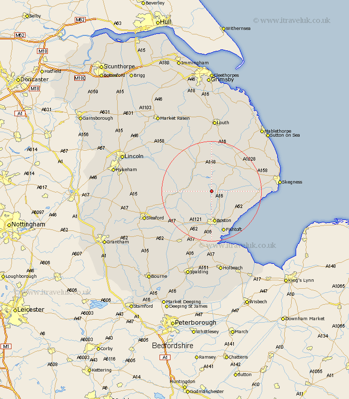
Lincolnshire Map Showing Location of New Bolingbroke
District: East Lindsey
Easting: 531658 Northing: 357706
Latitude: 53.1 Longitude: -0.03
 = New Bolingbroke
Easting: 531658 Northing: 357706
Latitude: 53.1 Longitude: -0.03
= New Bolingbroke
This New Bolingbroke map below is supplied by Google. Use the tools in the top left corner to zoom into street level or zoom out for a road map, you may also need to zoom in to see New Bolingbroke on the map. Click and drag the map to move around. If the map fails to load try and refresh your browser or zoom in or out (+ or -).
Update - it seems Google no longer allow people to use their maps for free! This New Bolingbroke map sometimes loads and sometimes gives a error. I am working on a solution.
Closest 30 Towns or Cities to New Bolingbroke (Population over 500)
Carrington 2.16km Stickney 3.82km Frithville 7.42km Sibsey 8.13km Coningsby 9.09km Mareham 9.53km Mareham on the Hill 9.53km Mareham-on-the-Hill 9.53km Tattershall 11.13km Horncastle 12.43km Banovallum 12.43km Wrangle 12.47km Spilsby 12.84km Old Leake 12.85km Leake 12.85km Boston 13.02km Woodhall Spa 13.44km Leverton 13.58km Brothertoft 13.72km Butterwick 14.6km Friskney 14.94km Bennington 15.14km Benington 15.14km Freiston 15.83km Frieston 15.83km Billinghay 16.8km Fishtoft 17.26km Wyberton 18.57km Wainfleet All Saints 18.92km Wainfleet 18.92km