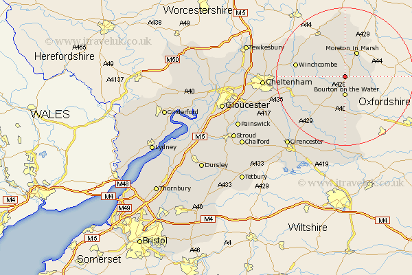
Gloucestershire Map Showing Location of Lower Swell
District: Cotswold
Easting: 417192 Northing: 224319
Latitude: 51.92 Longitude: -1.75
 = Lower Swell
Easting: 417192 Northing: 224319
Latitude: 51.92 Longitude: -1.75
= Lower Swell
This Lower Swell map below is supplied by Google. Use the tools in the top left corner to zoom into street level or zoom out for a road map, you may also need to zoom in to see Lower Swell on the map. Click and drag the map to move around. If the map fails to load try and refresh your browser or zoom in or out (+ or -).
Update - it seems Google no longer allow people to use their maps for free! This Lower Swell map sometimes loads and sometimes gives a error. I am working on a solution.
Closest 30 Towns or Cities to Lower Swell (Population over 500)
Stow-on-the-Wold 2.17km Stow on the Wold 2.17km Bourton-on-the-Water 5.56km Bourton on the Water 5.56km Moreton in Marsh 8.16km Moreton in the Marsh 8.16km Moreton-in-Marsh 8.16km Bledington 8.83km Northleach 10.34km Blockley 11.12km Chipping Campden 13.16km Winchcombe 14.2km Winchcomb 14.2km Andoversford 14.81km Ebrington 14.87km Withington 16.57km Chedworth 17.3km Dumbleton 18.55km Mickleton 18.56km Alderton 18.66km Bibury 19.09km Southam 20.65km Bishops Cleeve 22.02km North Cerney 22.36km Quenington 22.36km Charlton Kings 22.43km Cheltenham 22.94km Leckhampton 23.54km Swindon 24.07km Fairford 24.21km