Suffolk Map Showing Location of Little Saxham
District: St. Edmundsbury
Easting: 579805 Northing: 262767
Latitude: 52.23 Longitude: 0.63
 = Little Saxham
Easting: 579805 Northing: 262767
Latitude: 52.23 Longitude: 0.63
= Little Saxham
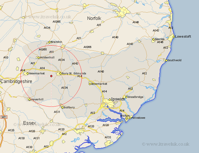
This Little Saxham map below is supplied by Google. Use the tools in the top left corner to zoom into street level or zoom out for a road map, you may also need to zoom in to see Little Saxham on the map. Click and drag the map to move around. If the map fails to load try and refresh your browser or zoom in or out (+ or -).
Update - it seems Google no longer allow people to use their maps for free! This Little Saxham map sometimes loads and sometimes gives a error. I am working on a solution.
Closest 30 Towns or Cities to Little Saxham (Population over 500)
Barrow 3.41km Risby 3.71km Chevington 3.87km Chedburgh 5.67km Fornham All Saints 5.86km Bury St Edmunds 5.97km Bury Saint Edmunds 5.97km Bury St. Edmunds 5.97km Gazeley 8.16km Rushbrooke 9.27km Great Barton 9.81km Wickhambrook 10.32km Moulton 10.38km Lawshall 11.5km Bradfield Saint George 11.94km Bradfield St. George 11.94km Bradfield St George 11.94km Bradfield 11.94km Thurston 12.62km Troston 13.79km Cockfield 13.8km Pakenham 14.11km Newmarket 14.87km Glemsford 15km Mildenhall 15.21km Ixworth 15.5km Hundon 15.87km Honington 15.88km Norton 16km Barnham 16.32km