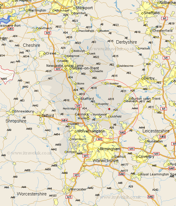
Staffordshire Map Showing Location of Kings Bromley
District: Lichfield
Easting: 412377 Northing: 315127
Latitude: 52.73 Longitude: -1.82
 = Kings Bromley
Easting: 412377 Northing: 315127
Latitude: 52.73 Longitude: -1.82
= Kings Bromley
This Kings Bromley map below is supplied by Google. Use the tools in the top left corner to zoom into street level or zoom out for a road map, you may also need to zoom in to see Kings Bromley on the map. Click and drag the map to move around. If the map fails to load try and refresh your browser or zoom in or out (+ or -).
Update - it seems Google no longer allow people to use their maps for free! This Kings Bromley map sometimes loads and sometimes gives a error. I am working on a solution.
Closest 30 Towns or Cities to Kings Bromley (Population over 500)
Yoxall 2.91km Armitage 4.49km Longdon 4.85km Lichfield 5.56km Alrewas 5.91km Whittington 6.5km Colton 7.69km Burntwood 7.9km Rugeley 8.69km Elford 8.74km Tatenhill 9.62km Edingale 9.72km Hammerwich 10.29km Abbots Bromley 10.3km Shenstone 11.18km Branston 11.52km Norton Canes 11.53km Hanbury 12.45km Colwich 12.52km Hednesford 12.89km Anslow 12.9km Wigginton 12.91km Brownhills 13.62km Cannock 14.58km Clifton Campville 14.58km Marchington 14.88km Huntington 15.06km Fazeley 15.17km Wyrley 15.24km Great Wyrley 15.24km