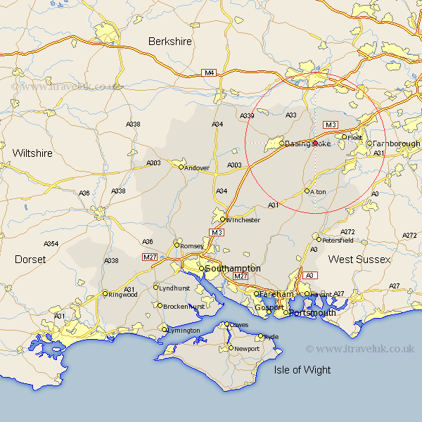
Hampshire Map Showing Location of Hook
Population: 6330
Area Size (ha): 189
District: Hart
Easting: 473246 Northing: 152529
Latitude: 51.27 Longitude: -0.95
 = Hook
Area Size (ha): 189
District: Hart
Easting: 473246 Northing: 152529
Latitude: 51.27 Longitude: -0.95
= Hook
This Hook map below is supplied by Google. Use the tools in the top left corner to zoom into street level or zoom out for a road map, you may also need to zoom in to see Hook on the map. Click and drag the map to move around. If the map fails to load try and refresh your browser or zoom in or out (+ or -).
Update - it seems Google no longer allow people to use their maps for free! This Hook map sometimes loads and sometimes gives a error. I am working on a solution.
Closest 30 Towns or Cities to Hook (Population over 500)
Rotherwick 2.18km Odiham 2.19km Winchfield 4.64km Long Sutton 5.68km Basing 5.8km Sherfield upon Loddon 5.93km Sherfield 5.93km Hartley Wintney 5.93km Upton Grey 6.56km Fleet 8.32km Crondall 8.91km Basingstoke 9.28km Bramley 9.83km Bentley 10.94km Froyle 11.36km Silchester 12.31km Blackwater 12.85km Aldershot 12.89km Binsted 13.78km Alton 15.01km Farnborough 15.07km Tadley 15.75km Dummer 15.78km Oakley 16.34km Baughurst 16.79km Kingsley 17.66km North Waltham 17.86km Four Marks 18.08km Bordon Camp 18.08km Bordon 18.08km