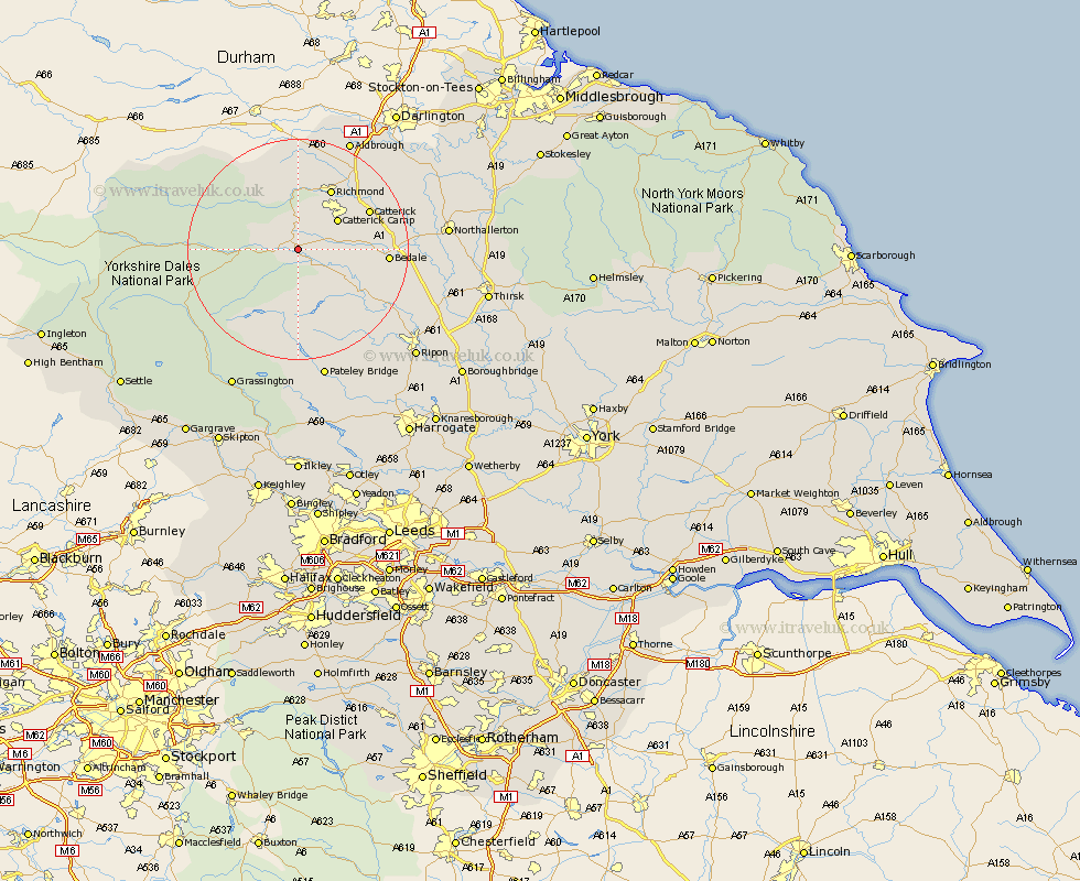
Yorkshire Map Showing Location of Leyburn
Population: 1703
Area Size (ha): 61
District: Richmondshire
Easting: 411929 Northing: 489409
Latitude: 54.3 Longitude: -1.82
 = Leyburn
Area Size (ha): 61
District: Richmondshire
Easting: 411929 Northing: 489409
Latitude: 54.3 Longitude: -1.82
= Leyburn
This Leyburn map below is supplied by Google. Use the tools in the top left corner to zoom into street level or zoom out for a road map, you may also need to zoom in to see Leyburn on the map. Click and drag the map to move around. If the map fails to load try and refresh your browser or zoom in or out (+ or -).
Update - it seems Google no longer allow people to use their maps for free! This Leyburn map sometimes loads and sometimes gives a error. I am working on a solution.
Closest 30 Towns or Cities to Leyburn (Population over 500)
Middleham 1.86km Richmond 12.36km Crakehall 12.98km Bradley 13.44km Catterick 14.01km Masham 14.25km Bedale 15.26km Gilling 16.18km Scorton 16.82km Grewelthorpe 16.9km Kirkby Malzeard 18.36km West Tanfield 19.68km Tanfield 19.68km Middleton Tyas 19.87km North Cowton 20.55km Barton 21.45km Melsonby 22.13km Cowton 22.48km East Cowton 22.48km Bewerley 24.31km Hawes 24.87km Northallerton 25.14km Brompton 26.53km Grassington 28.12km Ripon 28.21km Dacre 28.55km Darley 30.61km Threshfield 30.7km Dishforth 30.89km Topcliffe 31km