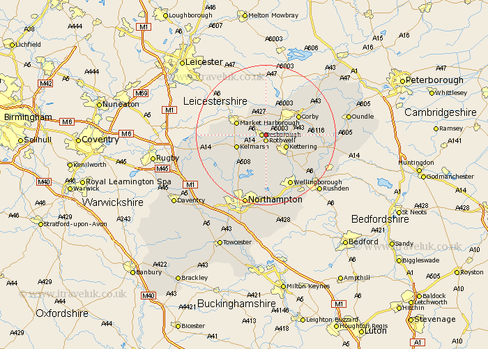
Northamptonshire Map Showing Location of Glaisdale
District: Kettering
Easting: 481573 Northing: 282421
Latitude: 52.43 Longitude: -0.8
 = Glaisdale
Easting: 481573 Northing: 282421
Latitude: 52.43 Longitude: -0.8
= Glaisdale
This Glaisdale map below is supplied by Google. Use the tools in the top left corner to zoom into street level or zoom out for a road map, you may also need to zoom in to see Glaisdale on the map. Click and drag the map to move around. If the map fails to load try and refresh your browser or zoom in or out (+ or -).
Update - it seems Google no longer allow people to use their maps for free! This Glaisdale map sometimes loads and sometimes gives a error. I am working on a solution.
Closest 30 Towns or Cities to Glaisdale (Population over 500)
Desborough 1.13km Rowell 1.85km Rothwell 1.85km Wilbarston 5.56km Cottingham 6.51km Kettering 6.76km Broughton 7.74km Geddington 7.91km Clipston 10.34km Corby 10.61km Stanion 10.82km Caldecott 10.86km Walgrave 11.17km Isham 11.48km Weldon 12.59km Burton Latimer 12.95km Naseby 13.62km Brigstock 13.68km Gretton 14.32km Brixworth 14.63km Finedon 15.86km Pitsford 15.87km Wellingborough 16.3km Spratton 16.49km Sywell 16.72km Overstone 16.72km Moulton 17.02km Welford 17.05km Woodford 17.48km Guilsborough 17.55km