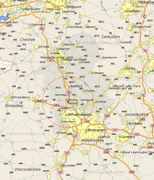
Staffordshire Map Showing Location of Four Ashes
District: South Staffordshire
Easting: 392113 Northing: 309556
Latitude: 52.68 Longitude: -2.12
 = Four Ashes
Easting: 392113 Northing: 309556
Latitude: 52.68 Longitude: -2.12
= Four Ashes
This Four Ashes map below is supplied by Google. Use the tools in the top left corner to zoom into street level or zoom out for a road map, you may also need to zoom in to see Four Ashes on the map. Click and drag the map to move around. If the map fails to load try and refresh your browser or zoom in or out (+ or -).
Update - it seems Google no longer allow people to use their maps for free! This Four Ashes map sometimes loads and sometimes gives a error. I am working on a solution.
Closest 30 Towns or Cities to Four Ashes (Population over 500)
Shareshill 2.91km Brewood 3.37km Penkridge 5.56km Huntington 5.92km Cannock 6.74km Great Wyrley 6.92km Wyrley 6.92km Wheaton Aston 7.69km Codsall 7.91km Hednesford 8.08km Bednall 9.87km Norton Canes 10.11km Church Eaton 10.8km Wolverhampton 11.18km Weston under Lizard 11.38km Weston 11.38km Weston-under-Lizard 11.38km Blymhill 11.83km Walsall 12.16km Wallsall 12.16km Haughton 12.45km Stafford 13.02km Bilston 13.4km Pelsall 13.46km Brownhills 13.56km Lower Penn 14.13km Gnossall 14.29km Gnosall 14.29km Colwich 14.29km Rushall 14.57km