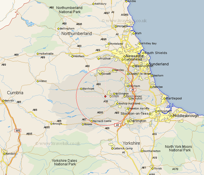
Durham Map Showing Location of Fir Tree
District: Wear Valley
Easting: 413961 Northing: 533919
Latitude: 54.7 Longitude: -1.78
 = Fir Tree
Easting: 413961 Northing: 533919
Latitude: 54.7 Longitude: -1.78
= Fir Tree
This Fir Tree map below is supplied by Google. Use the tools in the top left corner to zoom into street level or zoom out for a road map, you may also need to zoom in to see Fir Tree on the map. Click and drag the map to move around. If the map fails to load try and refresh your browser or zoom in or out (+ or -).
Update - it seems Google no longer allow people to use their maps for free! This Fir Tree map sometimes loads and sometimes gives a error. I am working on a solution.
Closest 30 Towns or Cities to Fir Tree (Population over 500)
Crook 3.21km Tow Law 4.28km Willington 5.67km High Etherley 5.96km Etherley 5.96km Wolsingham 6.69km West Auckland 8.08km Cornsay 9.32km Evenwood 9.32km Cockfield 9.32km Coundon 9.34km Bishop Auckland 9.34km Esh 10.7km Shildon 11.34km Spennymoor 11.78km Brandon 12.06km Ushaw Moor 12.61km Lanchester 13.37km Langley Park 13.41km Witton Gilbert 14.71km Staindrop 14.86km Ferryhill 15.11km Castleside 15.76km Durham 15.76km Stanhope 15.98km Newton Aycliffe 16.73km Sacriston 16.82km Consetti 16.98km Consett 16.98km Annfield Plain 16.98km